Home
Images
Vectors
Videos
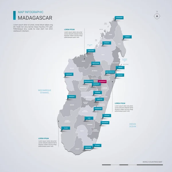
Stock vector Madagascar vector map with infographic elements, pointer marks. Editable template with regions, cities and capital Antananarivo.
Published:
Feb.21, 2019 07:29:19
Author:
molokowall
Views:
21
Downloads:
1
File type:
vector
/
eps
File size:
3.69 MB
Orginal size:
4000
x
4000
px
Available sizes:
S
(500 x 500)
M
(1000 x 1000)
L
(2000 x 2000)
XL
(4000 x 4000)
VECT
(4000 x 4000)
EL0
(4000 x 4000)
Level:
bronze
Download Vector
Vector topics:
Red
White
Blue
Vector
Background
Isolated
Travel
Border
Symbol
City
Contour
Information
Pin
Education
World
Template
Town
Globe
Identity
Point
Outline
Country
District
Map
Cartography
Geography
Continent
Land
Ground
State
Topography
Location
Political
Politics
Geographic
Region
Editable
Territory
Atlas
Nation
Subdivision
Mapping
Madagascar
Infographic
Travel Map
Vector Map
Madagascar Map
Similar stock vectors
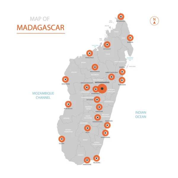
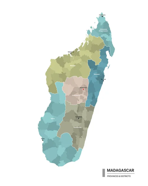
Stylized Vector Madagascar Map Showing Big Cities, Capital Antananarivo, Administrative Divisions.
3000 × 3000
Madagascar Map With Borders, Cities, Capital And Administrative Divisions. Infographic Vector Map. Editable Layers Clearly Labeled.
3000 × 4000
Madagascar Map With Location Pointer Marks. Infographic Vector Template, Isolated On White Background.
4000 × 5000
Vector People Map Of Madagascar . The Concept Of Population.
5000 × 5000
Madagascar Higt Detailed Map With Subdivisions. Administrative Map Of Madagascar With Districts And Cities Name, Colored By States And Administrative Districts. Vector Illustration With Editable And Labelled Layers.
4000 × 5000
Madagascar Map. Image Of A Global Map In The Form Of Regions Of Madagascar Regions. Country Flag. Infographic Timeline.
8000 × 4500
Vector Map Of Madagascar.
4000 × 4000
Golden Square Pattern Map Of Madagascar Island
5488 × 4555