Home
Images
Vectors
Videos
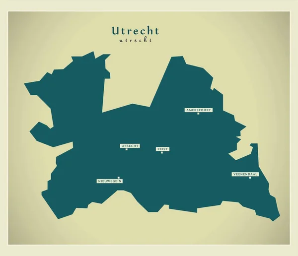
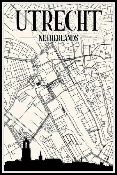
Stock vector map of the city of Utrecht, Netherlands
Published:
Oct.10, 2019 21:09:38
Author:
tish11
Views:
11
Downloads:
1
File type:
vector
/
eps
File size:
11.29 MB
Orginal size:
4859
x
6797
px
Available sizes:
S
(357 x 500)
M
(715 x 1000)
L
(1430 x 2000)
XL
(4859 x 6797)
VECT
(4859 x 6797)
EL0
(4859 x 6797)
Level:
bronze
Download Vector
Vector topics:
White
Vector
Graphic
Illustration
Travel
Park
Road
Gray
River
Center
City
Urban
Monochrome
Scale
Simple
Drawing
Street
Netherlands
Tourism
Grid
Highway
Town
Country
Map
Cartography
Geography
Plan
Land
Quarter
Topography
Location
Place
Geographical
2020
Rhine
Planing
Urbanism
2019
Utrecht
2021
Vleuten De Meern
Leidsche Rijn
Similar stock vectors
Retro Dutch City Map Of Utrecht Located In Utrecht. Vintage Street Map.
4724 × 7086
Map Of The City Of Utrecht, Netherlands
4859 × 6797
Abstract Street Map Of Utrecht Located In Utrecht Municipality Of Utrecht. City Map With Lines
4724 × 7086
Dark Printout City Poster With Panoramic Skyline And Hand-drawn Streets Network On Dark Gray Background Of The Downtown UTRECHT, NETHERLANDS
4080 × 6080
Technical Drawing Printout City Poster With Panoramic Skyline And Hand-drawn Streets Network On Blue Background Of The Downtown UTRECHT, NETHERLANDS
4080 × 6080
Modern Map - Utrecht Nl
3890 × 3349
Light Printout City Poster With Panoramic Skyline And Hand-drawn Streets Network On Vintage Beige Background Of The Downtown UTRECHT, NETHERLANDS
4080 × 6080
Yellow Printout City Poster With Panoramic Skyline And Hand-drawn Streets Network On Dark Gray Background Of The Downtown UTRECHT, NETHERLANDS
4080 × 6080