Home
Images
Vectors
Videos
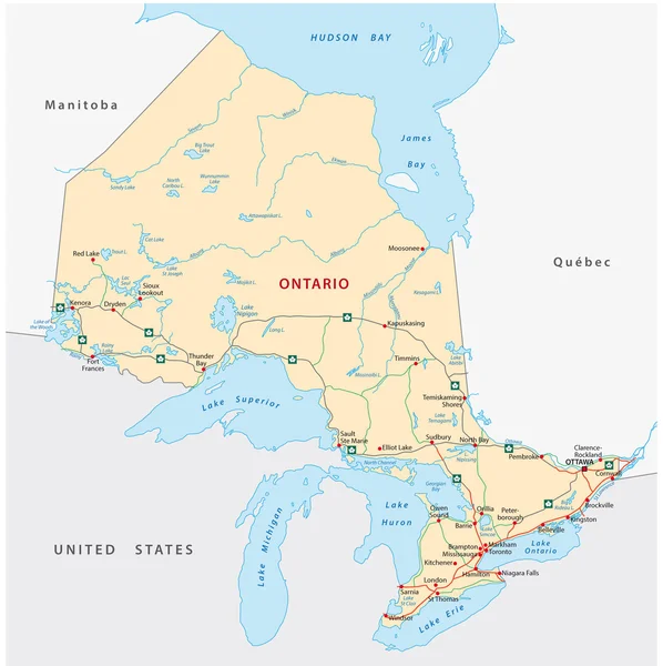
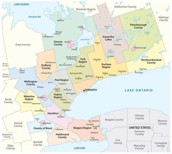
Stock vector Map of the Golden Horseshoe metropolitan area around the western end of Lake Ontario, Ontario, Canada
Published:
Aug.01, 2019 13:22:19
Author:
Lesniewski
Views:
145
Downloads:
9
File type:
vector
/
eps
File size:
1.54 MB
Orginal size:
3455
x
3100
px
Available sizes:
S
(500 x 449)
M
(1000 x 897)
L
(2000 x 1795)
XL
(3455 x 3100)
VECT
(3455 x 3100)
EL0
(3455 x 3100)
Level:
bronze
Download Vector
Vector topics:
Green
Color
Vector
Colorful
Graphic
Illustration
Travel
Border
City
Contour
Coast
Town
Capital
North
Outline
Country
District
Map
Cartography
Geography
Area
Lake
America
Boundary
Political
Administrative
Canada
Community
Toronto
Region
Territory
Province
Municipal
Metropolitan
County
Greater
Ontario
Mapping
Municipality
Niagara
Districts
North America
United States
Lake Ontario
Lake Erie
Lake Huron
Golden Horseshoe
Greater Toronto
Similar stock vectors
Map Of The Golden Horseshoe Metropolitan Area Around The Western End Of Lake Ontario Ontario Canada
4000 × 3936
Toronto Road And Administrative Map
4976 × 3632
Lake Ontario Drainage Basin Vector Map
3800 × 3100
Road Map With Flag Of The Canada Atlantic Province New Brunswick
3157 × 3100
Province Manitoba Vector Road And Travel Map
3100 × 4570
Ontario Road Map
2541 × 2545
Lake Erie Drainage Basin Vector Map
3769 × 3100
Map Of The Great Lakes And St Lawrence River Drainage Aregions
5064 × 3100