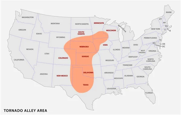
Stock vector Map of the Tornado Alley area in the United States

Published: May.17, 2019 06:37:58
Author: Lesniewski
Views: 136
Downloads: 5
File type: vector / eps
File size: 0.67 MB
Orginal size: 4820 x 3100 px
Available sizes:
Level: bronze