Home
Images
Vectors
Videos
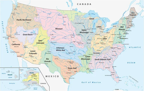
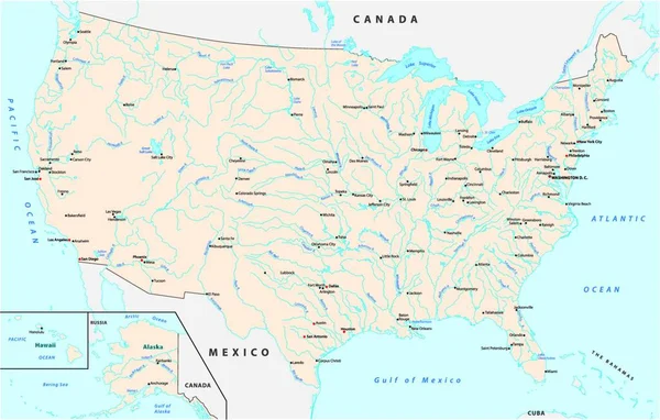
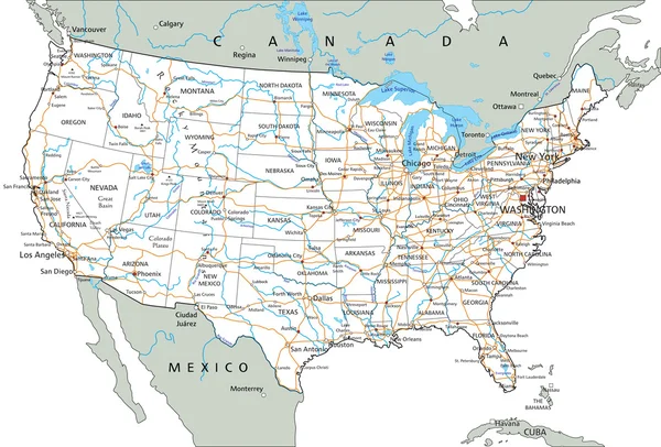
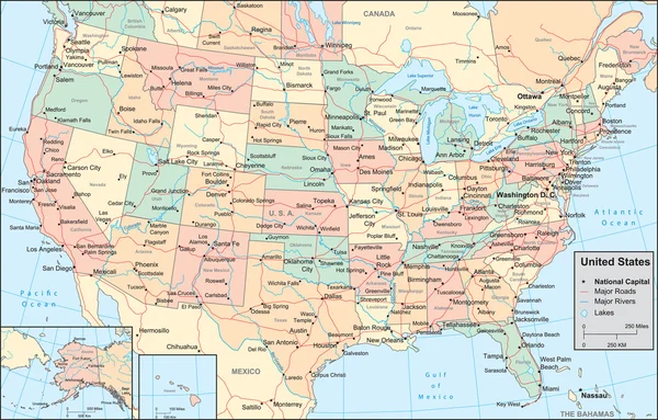
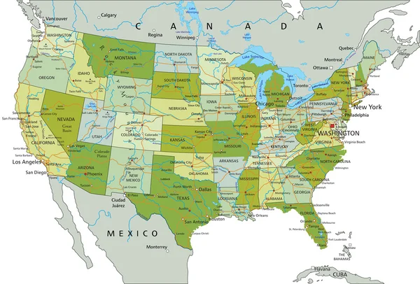
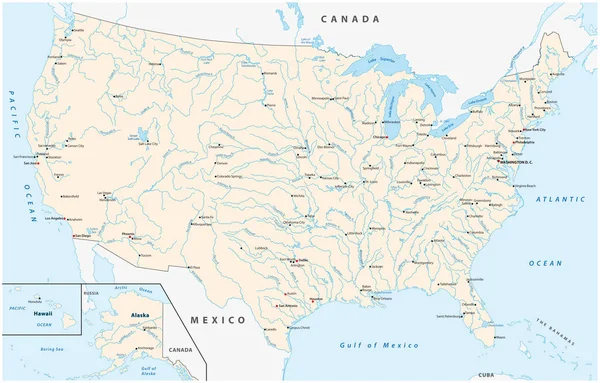
Stock vector Map of the United States with major cities, rivers and lakes
Published:
Jan.20, 2020 14:30:43
Author:
Lesniewski
Views:
175
Downloads:
2
File type:
vector
/
eps
File size:
3.04 MB
Orginal size:
4849
x
3100
px
Available sizes:
S
(500 x 320)
M
(1000 x 639)
L
(2000 x 1279)
XL
(4849 x 3100)
VECT
(4849 x 3100)
EL0
(4849 x 3100)
Level:
bronze
Download Vector
Vector topics:
Vector
Background
Illustration
Travel
Sea
Border
River
City
Contour
Us
Usa
Ocean
Capital
North
Outline
Country
Map
Cartography
Geography
National
Hawaii
Lake
Topography
America
Canada
Of
Atlantic
United
Geographic
States
Washington
York
Territory
Mexico
Atlas
Austin
Houston
Mapping
Mississippi
Missouri
Dallas
Pacific Ocean
United States Of America
Los Angeles
New York City
Atlantic Ocean
Gulf Of Mexico
Great Lakes Alaska
Similar stock vectors
Map Of The Watersheds In The United States Of America
3552 × 2264
United States Of America Physical Map
5671 × 3844
United States Of America Physical Map
5640 × 3844
United States, Rivers And Lakes, Political Map. The Main Stems Of The Longest Rivers, And The Largest Lakes Of The United States Of America, With The Great Lakes Of North America. Illustration. Vector
9000 × 6000
Map Of The United States With Major Cities Rivers And Lakes
4000 × 3691
United States Of America Road Map
5671 × 3844
United States Of America Map
3508 × 2244
United States Of America Map
5671 × 3844