Home
Images
Vectors
Videos
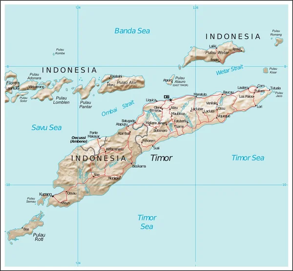
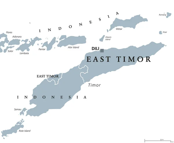
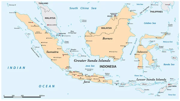
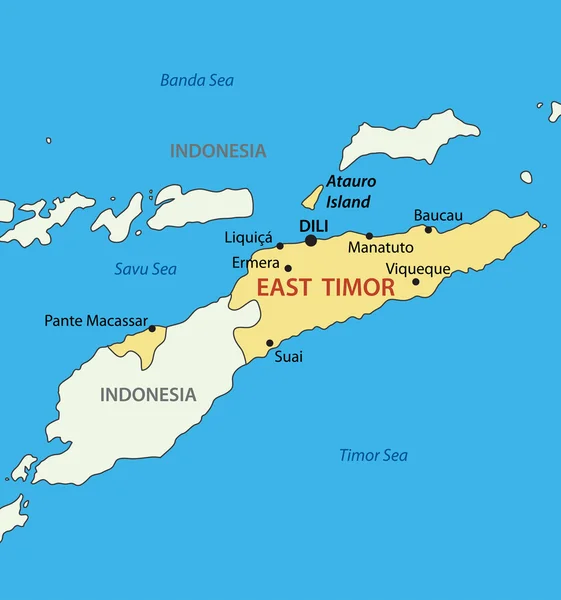
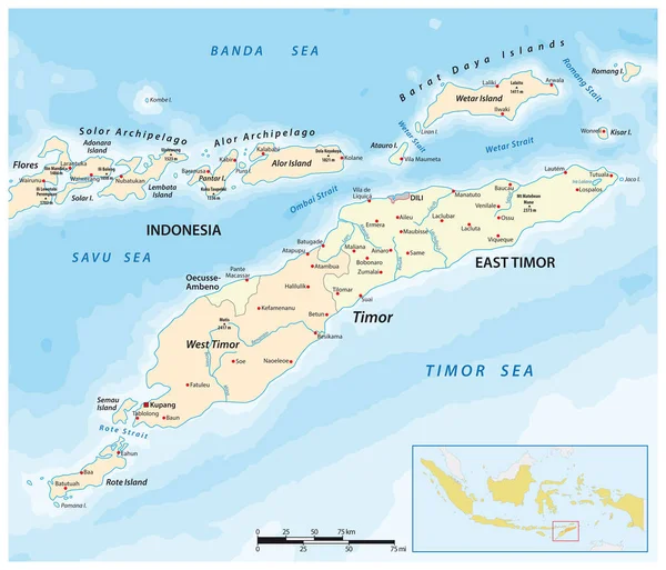
Stock vector Map of Timor Island, East Timor and Indonesia
Published:
May.13, 2021 07:53:51
Author:
Lesniewski
Views:
20
Downloads:
2
File type:
vector
/
eps
File size:
1.98 MB
Orginal size:
3622
x
3100
px
Available sizes:
S
(500 x 428)
M
(1000 x 856)
L
(2000 x 1712)
XL
(3622 x 3100)
VECT
(3622 x 3100)
EL0
(3622 x 3100)
Level:
bronze
Download Vector
Vector topics:
Color
Vector
Background
Graphic
Illustration
Design
Shape
Travel
Abstract
Border
Flores
River
City
Contour
Scale
Detailed
Outline
Country
Map
Cartography
Geography
Land
Lake
Asia
State
Location
Boundary
Island
Political
Airport
Republic
Region
Province
Nation
Indonesia
Mapping
Democratic
Timor
Archipelago
Dili
Banda
Exclave
Infographic
Timor Sea
East Timor
Banda Sea
West Timor
Savu Sea
Oecusse Ambeno
Similar stock vectors
Vector Road Map Of The Greater Sunda Island Sulawesi, Indonesia
3100 × 3963
East Timor Physiography Map
5282 × 4877
East Timor Or Also Timor Leste Political Map
8777 × 7222
Map Of The Greater Sunda Islands In The Malay Archipelago
5502 × 3100
Democratic Republic Of Timor-Leste - East Timor - Vector Map
3772 × 4029
Map Of Indonesia
6616 × 2623
Map Of Indonesia
5562 × 2877
East Timor Political Map
7292 × 6000