Home
Images
Vectors
Videos
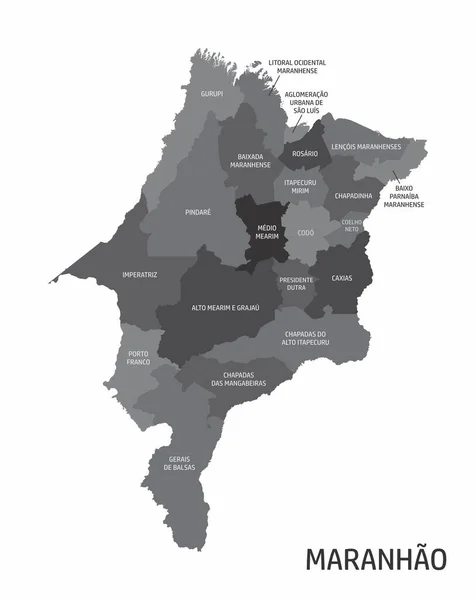
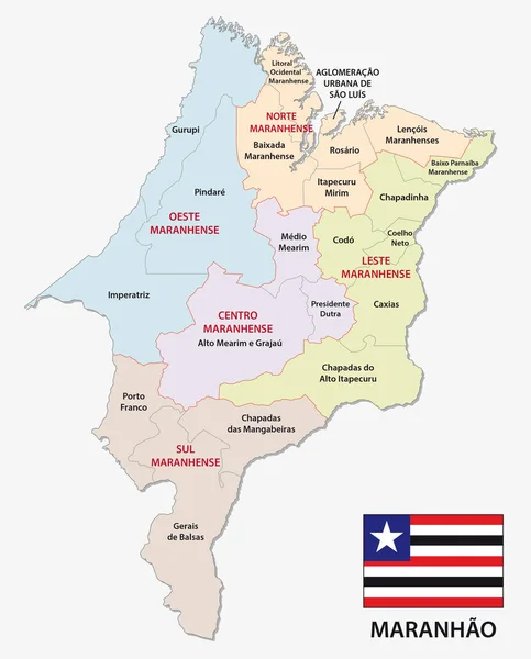
Stock vector maranhao administrative and political map with flag
Published:
Apr.10, 2017 13:01:09
Author:
Lesniewski
Views:
923
Downloads:
13
File type:
vector
/
eps
File size:
1.13 MB
Orginal size:
3100
x
3844
px
Available sizes:
S
(403 x 500)
M
(806 x 1000)
L
(1613 x 2000)
XL
(3100 x 3844)
VECT
(3100 x 3844)
EL0
(3100 x 3844)
Level:
bronze
Download Vector
Vector topics:
Vector
Colorful
Graphic
Border
Flag
Symbol
Icon
South
Outline
Map
Cartography
Geography
State
America
Political
Region
Brazil
Mapping
Maranhão
South America
Administrativ
Microregion
Mesoregion
Similar stock vectors
High Quality Map With Flag State Of Brazil
4000 × 4000
The Maranhao State Regions Map With Labels On White Background, Brazil
3972 × 5000
Modern Map - Maranhao BR Brazil
4436 × 5002
Modern Map - Maranhao BR
5000 × 5530
Sao Tome And Principe
4706 × 7004
Brazil Administrative Map, Vector Illustration
4656 × 4792
Rio Grande Do Sul Map, State Of Brazil. Vector Illustration.
4000 × 4001
Modern Light Blue Color High Detailed Border Map Of Brazil Isolated On Blue Background Vector
5000 × 4000