Home
Images
Vectors
Videos
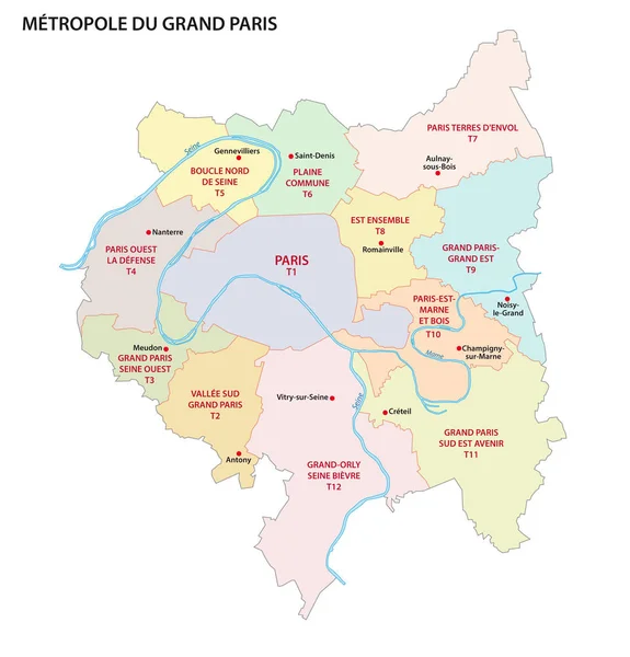
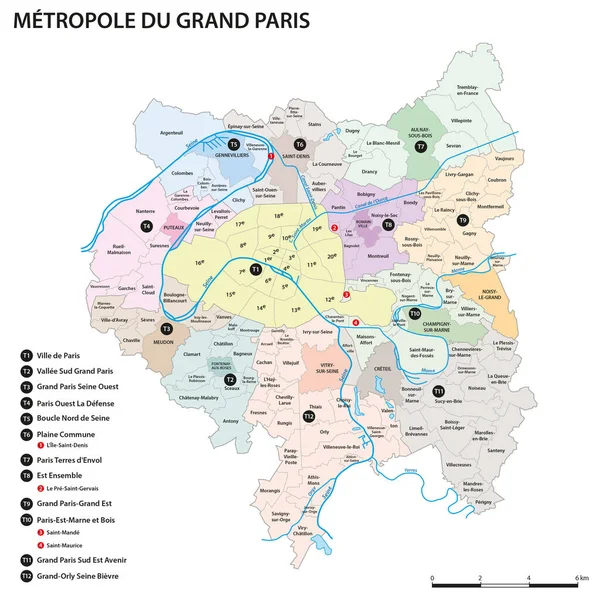
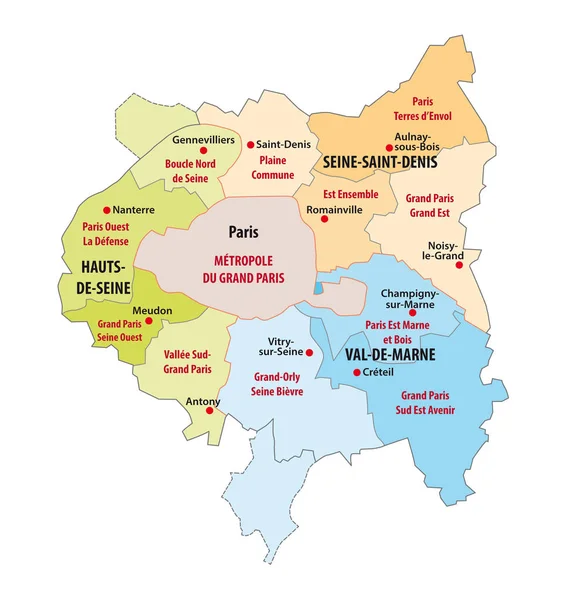
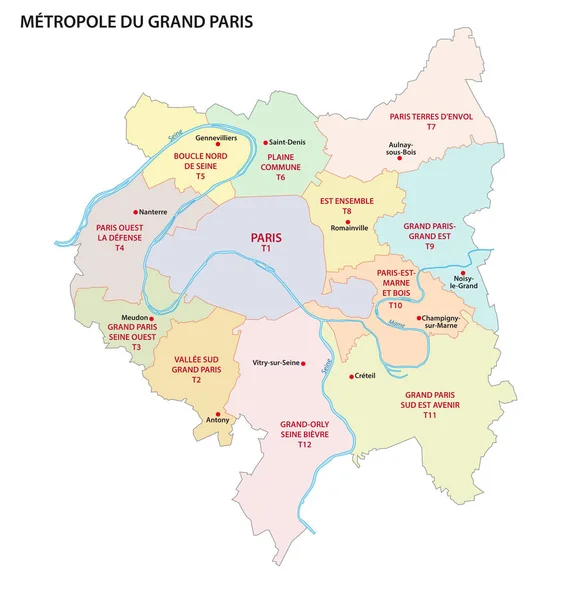
Stock vector Metropolis of Greater Paris administrative and political vector map
Published:
Jun.06, 2018 06:18:21
Author:
Lesniewski
Views:
6
Downloads:
0
File type:
vector
/
eps
File size:
0.85 MB
Orginal size:
3100
x
3232
px
Available sizes:
S
(480 x 500)
M
(959 x 1000)
L
(1918 x 2000)
XL
(3100 x 3232)
VECT
(3100 x 3232)
EL0
(3100 x 3232)
Level:
bronze
Download Vector
Vector topics:
Vector
Background
Colorful
Graphic
Illustration
Design
Abstract
Border
City
Contour
France
Europe
Outline
Country
District
Map
Cartography
Geography
Metropolis
State
Political
Administrative
Suburbs
Republic
Department
Paris
Region
Province
Seine
Nation
Mapping
Ile De France
Marne
Communes
Metropolitan Region
Greater Paris
Inner Suburban
Similar stock vectors
Metropolis Of Greater Paris Administrative And Political Vector Map, France
3100 × 3232
Vector Map Of The Union Of Municipalities Of Metropolis Of Greater Paris, France
3102 × 3100
Administrative Map Of The Municipal Association In The Ile-de-France
3100 × 3265
Paris - Grand Est - Centre - Val De Loire - Bourgogne Map France
6752 × 5000
Detailed Administrative Map Of The Ile-de-France Region, France
4294 × 3100
Centre - Val De Loire Red Highlighted In Map Of France
5908 × 5100
Hauts De France Red Highlighted In Map Of France
5908 × 5100
Vector Map Of France With Main Cities On It. French Cities Skylines Icons
8542 × 8415