Home
Images
Vectors
Videos
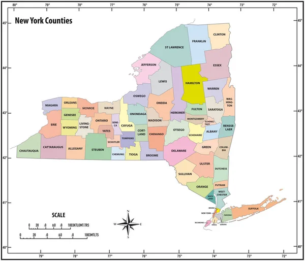
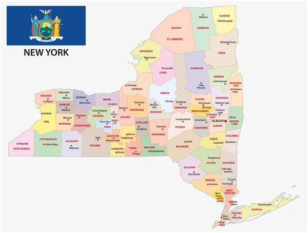
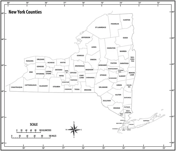
Stock vector new york state outline administrative and political vector map in black and white
Published:
Apr.26, 2018 12:54:02
Author:
Lesniewski
Views:
59
Downloads:
2
File type:
vector
/
eps
File size:
0.93 MB
Orginal size:
3616
x
3100
px
Available sizes:
S
(500 x 429)
M
(1000 x 857)
L
(2000 x 1715)
XL
(3616 x 3100)
VECT
(3616 x 3100)
EL0
(3616 x 3100)
Level:
bronze
Download Vector
Vector topics:
White
Vector
Background
Graphic
Illustration
Design
New
Travel
Black
Border
City
Contour
Scale
American
Usa
Detailed
Long
Outline
Country
District
Map
Cartography
Geography
Kilometers
State
America
Countries
Island
Political
Administrative
United
States
Region
York
Miles
Territory
Province
Nation
Ny
County
Mapping
Coordinates
Counties
North America
United States
North Arrow
Similar stock vectors
New York State Outline Administrative And Political Vector Map In Color
3616 × 3100
The Black And White New York State County Maps
3504 × 5404
White Outline Counties Map With Counties Names Of US State Of New York
4800 × 3600
High Quality Map State Of United States. New York
4000 × 4000
New York Administrative Map With Flag
4472 × 3387
Map Of The Counties In The Four Divisions Of The New York Metropolitan Area
3949 × 3100
Colorful County Map With Counties Names Of The US Federal State Of New York
4800 × 3600
Shape Of New York, State Of Mainland United States, With Its Capital Isolated On Solid Background. Distance Scale, Region Preview And Labels. Satellite Imagery. 3D Rendering
2880 × 1620