Home
Images
Vectors
Videos
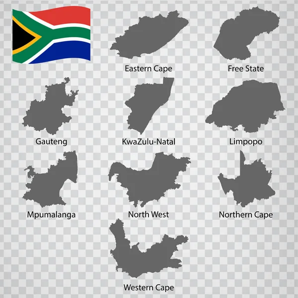
Stock vector Nine Maps provinces of South Africa - alphabetical order with name. Every single map of Province are listed and isolated with wordings and titles. South Africa. EPS 10.
Published:
Jan.11, 2021 10:43:39
Author:
karinanh
Views:
31
Downloads:
3
File type:
vector
/
eps
File size:
6.65 MB
Orginal size:
5000
x
5000
px
Available sizes:
S
(500 x 500)
M
(1000 x 1000)
L
(2000 x 2000)
XL
(5000 x 5000)
VECT
(5000 x 5000)
EL0
(5000 x 5000)
Level:
bronze
Download Vector
Vector topics:
Eight
Image
Background
Graphic
Design
Transparent
Shape
Line
Silhouette
Border
Flag
Modern
Gray
Symbol
Concept
Icon
Blank
Flat
Contour
Wallpaper
Detailed
Outline
Country
Map
Cartography
Area
National
Africa
Land
State
Borders
Geographic
Nation
Johannesburg
Limpopo
Gauteng
Mpumalanga
Eastern Cape
South Africa
No People
North West
Western Cape
Kwazulu Natal
Free State
Northern Cape
Similar stock vectors
Hippo South Africa
5000 × 4000
South Africa - Detailed Blue Country Map With Cities, Regions, Location On World Map And Globe. Infographic Icons. Vector Illustration
5734 × 6918
South Africa
5454 × 4789
Western Cape Red Highlighted In Map Of South Africa
6482 × 5600
High Quality Map Of South Africa . Vector Illustration
4000 × 4000
Blue Map Of South Africa Administrative Divisions With Travel Infographic Icons. Vector Illustration
7508 × 5331