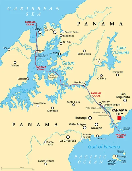
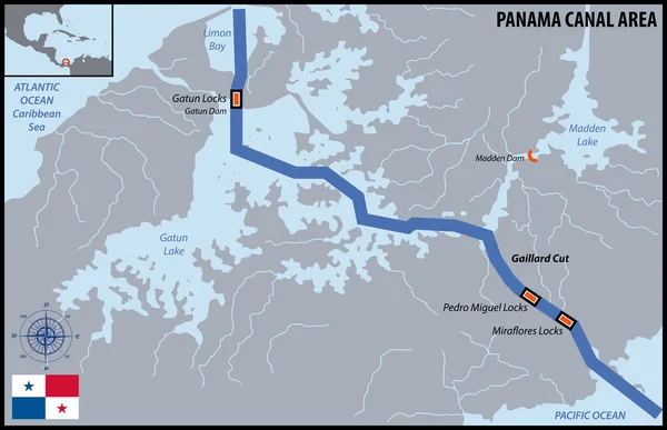
Stock vector Panama Canal, political map and schematic diagram, illustrating the sequence of locks and passages. An artificial waterway, connecting the Atlantic Ocean with the Pacific Ocean, and expanded in 2016.

Published: Sep.01, 2023 11:44:50
Author: Furian
Views: 72
Downloads: 1
File type: vector / eps
File size: 4.55 MB
Orginal size: 6000 x 8595 px
Available sizes:
Level: silver