Home
Images
Vectors
Videos
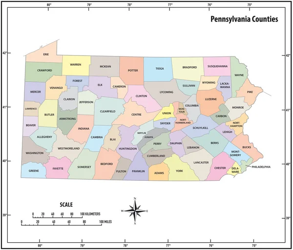
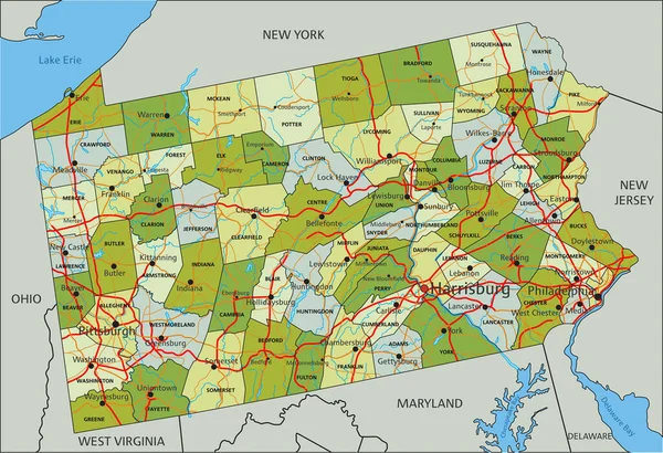
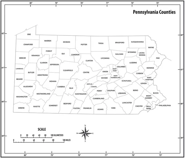
Stock vector pennsylvania state outline administrative and political vector map in black and white
Published:
Apr.27, 2018 06:22:04
Author:
Lesniewski
Views:
50
Downloads:
6
File type:
vector
/
eps
File size:
0.87 MB
Orginal size:
3618
x
3100
px
Available sizes:
S
(500 x 428)
M
(1000 x 857)
L
(2000 x 1714)
XL
(3618 x 3100)
VECT
(3618 x 3100)
EL0
(3618 x 3100)
Level:
bronze
Download Vector
Vector topics:
White
Vector
Background
Graphic
Illustration
Design
New
Travel
Black
Border
City
Contour
Scale
American
Usa
Detailed
Long
Outline
Country
District
Map
Cartography
Geography
Kilometers
State
America
Countries
Island
Political
Administrative
United
States
Region
York
Miles
Territory
Province
Nation
Ny
County
Mapping
Coordinates
Pennsylvania
Counties
North America
United States
North Arrow
Similar stock vectors
Pennsylvania State Outline Administrative And Political Vector Map In Color
3618 × 3100
Virginia State Outline Administrative And Political Vector Map In Black And White
5200 × 3100
Pennsylvania Vector Accurate High Detailed State Map With Commun
5001 × 3018
Maryland State Outline Administrative And Political Vector Map In Black And White
4000 × 3760
North Carolina - Highly Detailed Editable Political Map With Labeling.
7313 × 3584
Virginia State Outline Administrative And Political Vector Map In Black And White
4000 × 3735
Highly Detailed Editable Political Map With Separated Layers. Pennsylvania.
4223 × 2891
Highly Detailed Editable Political Map With Separated Layers. North Carolina.
7313 × 3584