
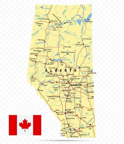
Stock vector Province of Alberta Map. Canada state with cities and towns
Published: Aug.16, 2021 09:05:04
Author: Cartarium
Views: 224
Downloads: 2
File type: vector / eps
File size: 3.81 MB
Orginal size: 5670 x 6580 px
Available sizes:
Level: bronze
Similar stock vectors


Alberta Map On Canadian Flag. AB, CA Province Map On Canada Flag. EPS Vector Graphic Clipart Icon
5000 × 4000

