Home
Images
Vectors
Videos
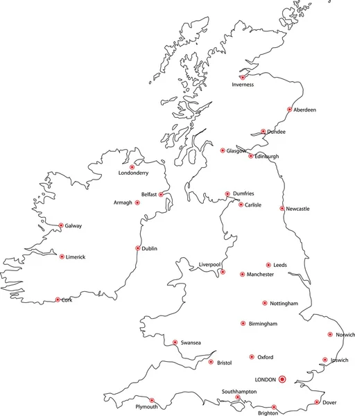
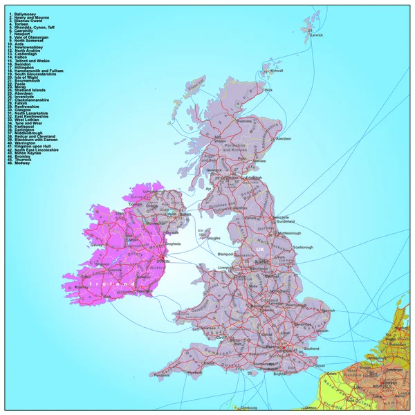
Stock vector Road and administrative map of UK and Ireland
Published:
Nov.11, 2014 15:02:19
Author:
BenKenogy
Views:
275
Downloads:
3
File type:
vector
/
ai
File size:
1.4 MB
Orginal size:
3900
x
3900
px
Available sizes:
S
(500 x 500)
M
(1000 x 1000)
L
(2000 x 2000)
XL
(3900 x 3900)
VECT
(3900 x 3900)
EL0
(3900 x 3900)
Level:
beginner
Download Vector
Vector topics:
Road
City
Highway
Town
Country
Map
Ireland
Uk
Railway
Region
Cities
England
Province
Scotland
Eire
Road Map
Similar stock vectors
Map Of United Kingdom
4201 × 7001
Black Outline Vector Map Of The British Isles & Cities
3239 × 3790
Political Map Of United Kingdom With The Several Countries.
3740 × 6850
Atlas Of Commercial Geography. Old Image
3347 × 4199
Linear Map Of Great Britain And Ireland With Spectral Gradient
4739 × 3377
Map Of United Kingdom Of Great Britain And Northern Ireland Black Thick Outline Highlighted With Neighbor Countries
6000 × 6000
Map Of United Kingdom On Earth
5000 × 3750
Outline United Kingdom Map
3843 × 6004