Home
Images
Vectors
Videos
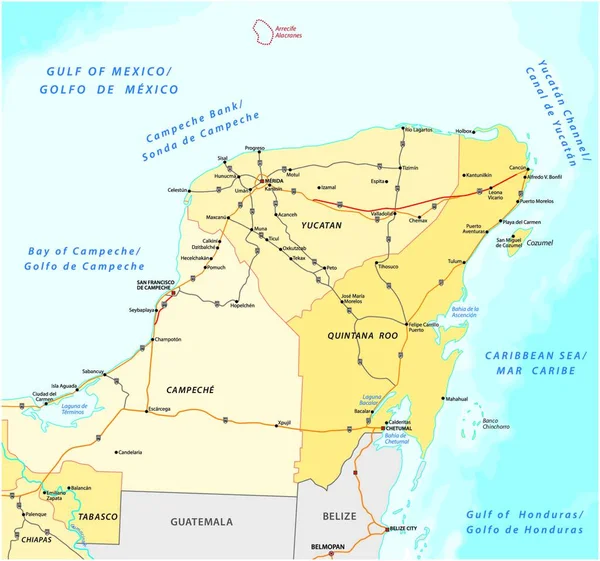
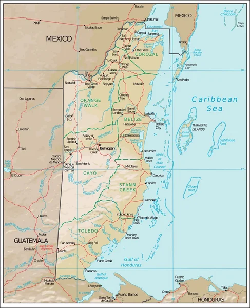
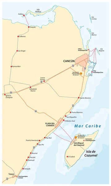
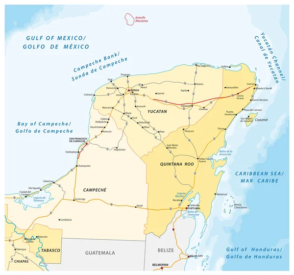
Stock vector road and administrative vector map of the Yucatan Peninsula
Published:
Aug.11, 2020 09:53:03
Author:
Lesniewski
Views:
32
Downloads:
6
File type:
vector
/
eps
File size:
1.55 MB
Orginal size:
3310
x
3100
px
Available sizes:
S
(500 x 468)
M
(1000 x 937)
L
(2000 x 1873)
XL
(3310 x 3100)
VECT
(3310 x 3100)
EL0
(3310 x 3100)
Level:
bronze
Download Vector
Vector topics:
Vector
Background
Graphic
Illustration
Art
Travel
Border
Road
City
Tourism
Outline
District
Map
Cartography
Geography
Area
Language
America
Political
Administrative
Gulf
Reef
States
Central
Spanish
Mexico
Peninsula
Maya
Mapping
Yucatan
Tabasco
Cancun
Belize
Guatemala
Belmopan
Campeche
Chiapas
Palenque
Valladolid
Caribbean Sea
Gulf Of Mexico
Quintana Roo
Chetumal
Chetumal Village
Similar stock vectors
Road And Administrative Vector Map Of The Yucatan Peninsula
4000 × 3975
Belize Political Map Isolated On White. Detailed Political Map Of Belize With The Capital Belmopan, National Borders, Roads, Most Important Cities, Rivers And Lakes Isolated On White.
3720 × 4500
Map Of The Olmec Cultural Zone On The Southern Gulf Coast Of Mexico
3939 × 3100
Belize Political Map. Detailed Political Map Of Belize With The Capital Belmopan, National Borders, Roads, Most Important Cities, Rivers And Lakes. Vector Illustration With English Labeling And Scale.
3720 × 4500
Belize Political Map Retro Color. Detailed Political Map Of Belize With The Capital Belmopan, National Borders, Most Important Cities, Rivers And Lakes. Vector Illustration With English Labeling And Scale.
3717 × 4500
Belize Vintage Color Map. Detailed Political Map Of Belize With The Capital Belmopan, National Borders, Roads, Most Important Cities, Rivers And Lakes In Vintage Colors. Vector Illustration With English Labeling And Scale.
3720 × 4500
Belize Physiography Map
5102 × 6283
Riviera Maya And The Holbox Island Road Vector Map
3100 × 5170