Home
Images
Vectors
Videos
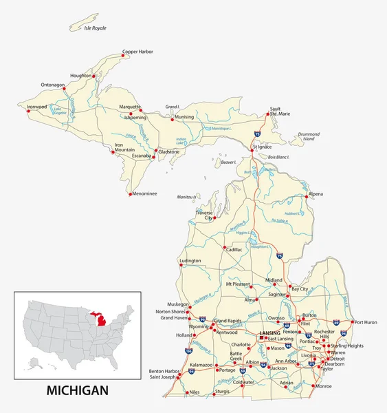
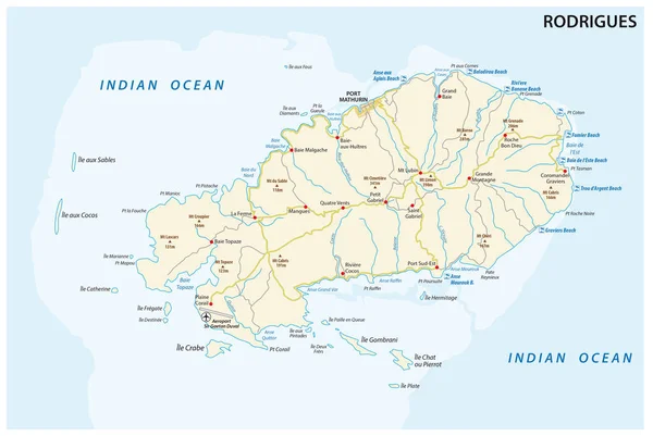
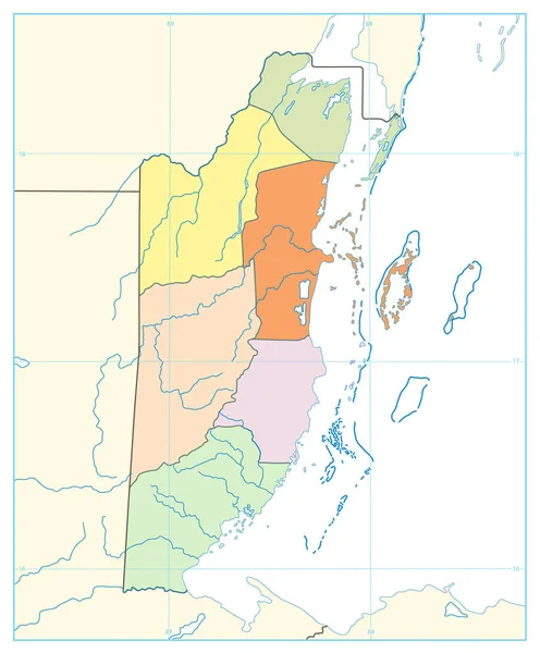
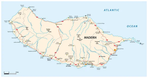
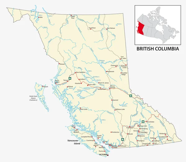
Stock vector Road map of the Canadian province of British Columbia.
Published:
Sep.04, 2018 06:26:57
Author:
Lesniewski
Views:
166
Downloads:
8
File type:
vector
/
eps
File size:
1.96 MB
Orginal size:
3543
x
3100
px
Available sizes:
S
(500 x 437)
M
(1000 x 875)
L
(2000 x 1750)
XL
(3543 x 3100)
VECT
(3543 x 3100)
EL0
(3543 x 3100)
Level:
bronze
Download Vector
Vector topics:
Color
Vector
Graphic
Illustration
Travel
Border
Road
River
City
Ocean
Detailed
Outline
Country
Map
Cartography
Geography
Pacific
Land
Lake
State
Topography
America
Island
Political
Canada
United
States
British
Province
Northwest
Columbia
Vancouver
Alaska
Victoria
Alberta
Idaho
Yukon
Geographical Locations
Similar stock vectors
Road Map Of The US American State Of Michigan.
3100 × 3303
Association Of Caribbean States Map
5370 × 4295
Rodrigues Island Road And Beach Vector Map
4631 × 3100
Belize Political Map. No Text. Isolated On White. Political Map Of Belize With National Borders, Rivers And Lakes Isolated On White. Vector Illustration.
3720 × 4500
Road Map Of The Portuguese Island Of Madeira
5894 × 3100
Road Map Of The US American State Of West Virginia
3933 × 3100
Administrative Map Of The Portuguese Island Of Madeira
5901 × 3100
China - Detailed Topographic Map - Illustration
7379 × 5900