Home
Images
Vectors
Videos
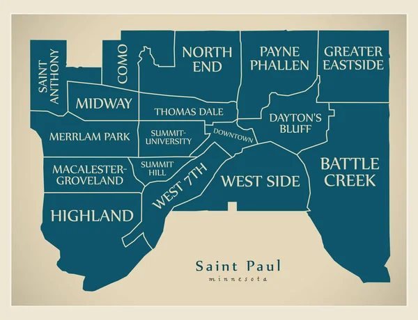
Stock vector Saint Paul Minnesota Map with neighborhoods and modern round shapes
Published:
Aug.02, 2018 09:43:26
Author:
ingomenhard
Views:
3
Downloads:
0
File type:
vector
/
eps
File size:
7.33 MB
Orginal size:
6671
x
5000
px
Available sizes:
S
(500 x 375)
M
(1000 x 750)
L
(2000 x 1499)
XL
(6671 x 5000)
VECT
(6671 x 5000)
EL0
(6671 x 5000)
Level:
bronze
Download Vector
Vector topics:
Vector
Round
Graphic
Illustration
Design
Isolated
Shape
New
Art
Silhouette
Modern
Creative
City
Flat
Simple
Usa
Artwork
Country
Map
Area
Trip
Different
State
Borders
Administrative
Department
Territory
Neighborhood
Minnesota
County
Divisions
Regional
Districts
Provinces
Regions
Boroughs
United States
United States Of America
St Paul
Saint Paul
Similar stock vectors
Modern City Map - Saint Paul Minnesota City Of The USA With Neighborhoods
6512 × 5000
Saint Paul Minnesota City Map With Neighborhoods Grey Illustration Silhouette Shape
6654 × 5000
Modern City Map - Saint Paul Minnesota City Of The USA With Neighborhoods And Titles
6512 × 5000
Saint Paul Minnesota City Map Grey Illustration Silhouette Shape
6654 × 5000
Seattle Washington Map With Neighborhoods And Modern Round Shapes
5000 × 7147
Milwaukee Wisconsin Map With Neighborhoods And Modern Round Shapes
5000 × 7637
Saint Paul Map, Capital City Of The USA State Of Minnesota. Municipal Administrative Area Map With Rivers And Roads, Parks And Railways. Vector Illustration.
4566 × 3739
Washington, Saint Louis US Vector Icon
5000 × 5263