Home
Images
Vectors
Videos
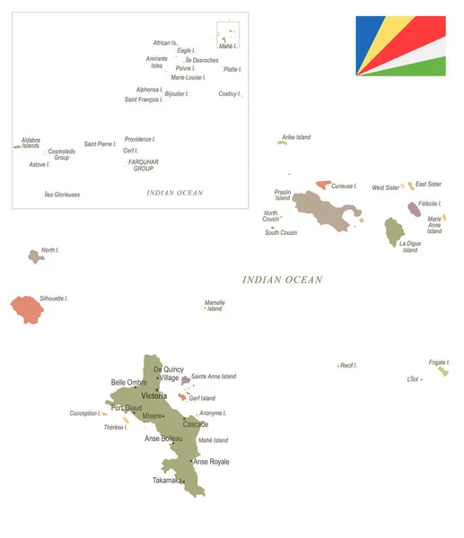
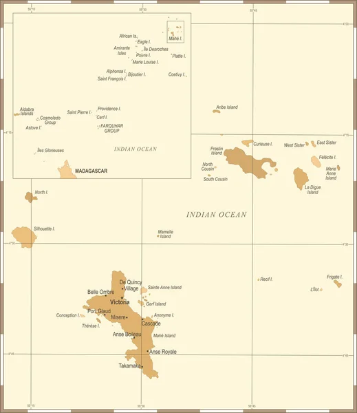
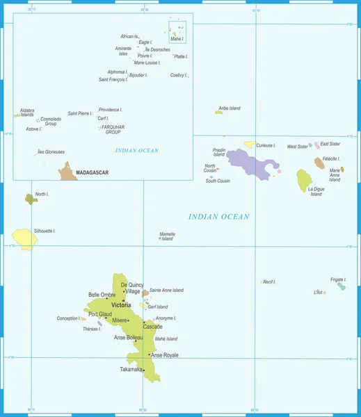
Stock vector Seychelles Map - Detailed Vector Illustration
Published:
Mar.02, 2018 18:46:21
Author:
dikobrazik
Views:
4
Downloads:
0
File type:
vector
/
eps
File size:
1.18 MB
Orginal size:
5500
x
6353
px
Available sizes:
S
(433 x 500)
M
(866 x 1000)
L
(1731 x 2000)
XL
(5500 x 6353)
VECT
(5500 x 6353)
EL0
(5500 x 6353)
Level:
silver
Download Vector
Vector topics:
Color
Blue
Vector
Illustration
Silhouette
Border
City
Contour
Detailed
Country
Map
Geography
Land
Topography
Political
Seychelles
Victoria
Regions
Mahe
Capital Cities
Navigational Equipment
Geographical Locations
East Africa
La Digue
Port Glod
De Quincy
Similar stock vectors
Seychelles Map - Vintage Detailed Vector Illustration
5500 × 6432
Seychelle Map - Vintage Detailed Vector Illustration
5500 × 6371
Vector Map Of The Portuguese Archipelago Madeira In The Atlantic Ocean, Portugal
3861 × 3100
Seychelle - Vintage Map And Flag - Detailed Vector Illustration
5500 × 6371
Vector Map Of The Lesser Antilles With The Martinique Archipelago
3100 × 3532
Cape Verde Map - Vintage Detailed Vector Illustration
7021 × 5500
Map Of The States Of The Lesser Antilles
6772 × 4893
Seychelle Map - Vintage Detailed Vector Illustration
5500 × 6353