Home
Images
Vectors
Videos
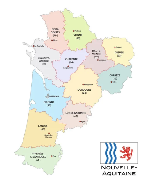
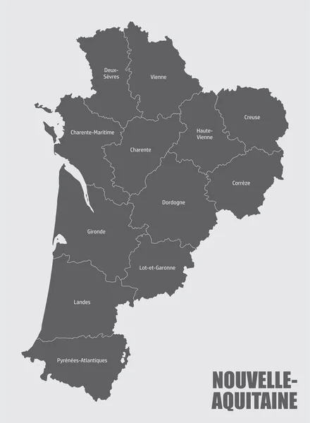
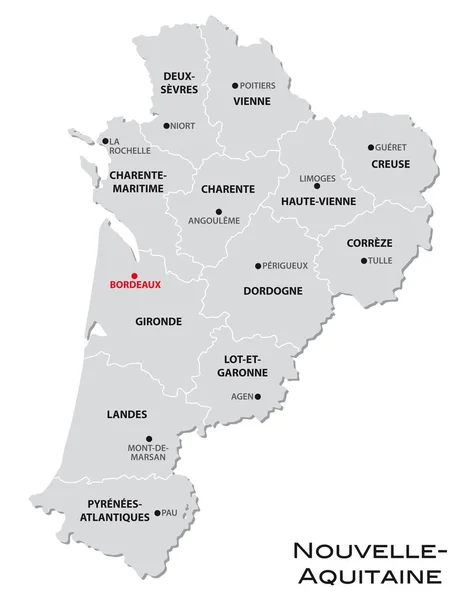
Stock vector simple gray administrative map of the new french region Nouvelle-Aquitaine
Published:
Jan.17, 2019 14:34:34
Author:
Lesniewski
Views:
69
Downloads:
1
File type:
vector
/
eps
File size:
0.65 MB
Orginal size:
3100
x
3909
px
Available sizes:
S
(397 x 500)
M
(793 x 1000)
L
(1586 x 2000)
XL
(3100 x 3909)
VECT
(3100 x 3909)
EL0
(3100 x 3909)
Level:
bronze
Download Vector
Vector topics:
White
Vector
Background
Graphic
Illustration
Design
Isolated
Shape
Simplicity
Business
New
Travel
European
French
Border
Gray
Symbol
Simple
France
Tourism
Europe
Outline
Country
Map
Cartography
Geography
Area
National
Land
State
Topography
Boundary
Political
Administrative
Geographic
Department
Official
Region
Division
Prefecture
Territory
Administration
Province
Metropolitan
Regional
2016
Territorial
Regions
Arrondissement
Nouvelle Aquitaine
Similar stock vectors
Simple Gray Administrative Map Of The New French Region Nouvelle Aquitaine
3865 × 4000
Administrative And Political Vector Map Of The Region Nouvelle-Aquitaine With Flag
3100 × 3861
Pays De La Loire - Paris - Centre - Val De Loire - Nouvelle - Aq
5000 × 6589
Nouvelle-Aquitaine Administrative Map Divided In Departments With Labels, France
3672 × 5000
Nouvelle-Aquitaine Red Highlighted In Map Of France
5908 × 5100
Nouvelle-Aquitaine Red Highlighted In Map Of France
7531 × 6500
Normandie Red Highlighted In Map Of France
5908 × 5100
Normandie Red Highlighted In Map Of France
7531 × 6500