photo free
Home Images Vectors Videos

Stock vector South Sandwich Islands, political map. Part of the British Overseas Territory of South Georgia and the South Sandwich Islands. Group of islands in the South Atlantic Ocean and Scotia Sea. Vector.
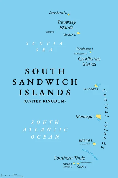
Stock vector South Sandwich Islands, political map. Part of the British Overseas Territory of South Georgia and the South Sandwich Islands. Group of islands in the South Atlantic Ocean and Scotia Sea. Vector.
Published: Apr.20, 2022 14:19:43
Author: Furian
Views: 4
Downloads: 0
File type: vector / eps
File size: 2.36 MB
Orginal size: 6000 x 9000 px
Available sizes:
S
(333 x 500)
M
(667 x 1000)
L
(1333 x 2000)
XL
(6000 x 9000)
VECT
(6000 x 9000)
EL0
(6000 x 9000)
Level: silver
Download Vector
Vector topics:

Similar stock vectors

stock vector Cape Verde Political Map

Cape Verde Political Map

7135 × 6000
stock vector Grunge Textured SOUTH SANDWICH ISLANDS Stamp Seal

Grunge Textured SOUTH SANDWICH ISLANDS Stamp Seal

4583 × 4583
stock vector The Caribbean Map - Vintage Vector Illustration

The Caribbean Map - Vintage Vector Illustration

6340 × 5500
stock vector Grand Cayman highly detailed vector map with main cities and roads.

Grand Cayman Highly Detailed Vector Map With Main Cities And Roads.

5000 × 3235
stock vector map of South Georgia and the South Sandwich Islands. Shape map and flag of South Georgia and the South Sandwich Islands country.

Map Of South Georgia And The South Sandwich Islands. Shape Map And Flag Of South Georgia And The South Sandwich Islands Country.

4000 × 4000
stock vector South Sandwich Islands Textile Stamps

South Sandwich Islands Textile Stamps

5108 × 4383
stock vector Map of the French Polynesian Archipelago Leeward Islands (Society Islands), France

Map Of The French Polynesian Archipelago Leeward Islands (Society Islands), France

4378 × 3100
stock image Argentinian Cartoon Map

Argentinian Cartoon Map

4000 × 4962