Home
Images
Vectors
Videos
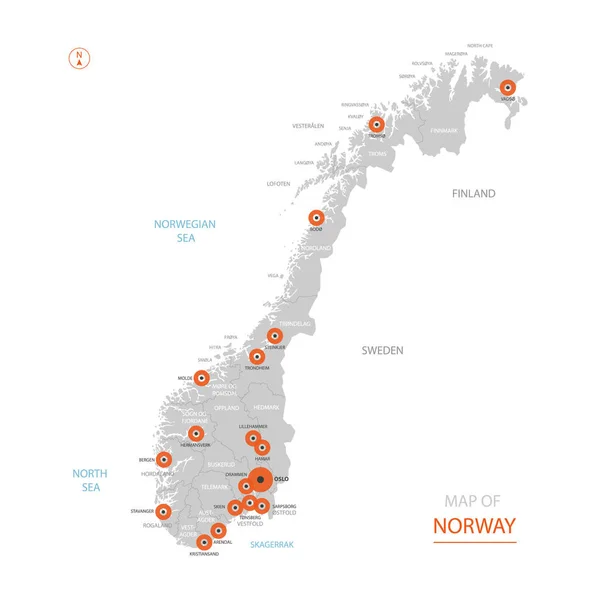
Stock vector Stylized vector Norway map showing big cities, capital Oslo, administrative divisions.
Published:
Sep.04, 2018 10:01:18
Author:
molokowall
Views:
12
Downloads:
0
File type:
vector
/
eps
File size:
2.73 MB
Orginal size:
4000
x
4000
px
Available sizes:
S
(500 x 500)
M
(1000 x 1000)
L
(2000 x 2000)
XL
(4000 x 4000)
VECT
(4000 x 4000)
EL0
(4000 x 4000)
Level:
bronze
Download Vector
Vector topics:
White
Vector
Background
Circle
Isolated
Travel
Orange
Border
Symbol
City
Contour
Grey
Information
Education
World
Town
Identity
Outline
Country
District
Map
Cartography
Geography
National
Continent
Land
Ground
State
Topography
Location
Political
Politics
Geographic
Region
Territory
Atlas
Norway
Oslo
Nation
Subdivision
Mapping
Infographic
Travel Map
Vector Map
Norway Map
Similar stock vectors
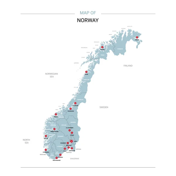
Norway Vector Map. Editable Template With Regions, Cities, Red Pins And Blue Surface On White Background.
3000 × 3000
Norway Map With Borders, Cities, Capital And Administrative Divisions. Infographic Vector Map. Editable Layers Clearly Labeled.
3000 × 4000
Norway Communication Network Map. Vector Image Of A Low Poly Global Map With City Lights.
8192 × 5595
Autumn Leaves - Mosaic Map Of Norway
5420 × 3000
Norway Vector Map Infographic Template. Slide Presentation. Oslo, Bergen. Global Business Marketing Concept. Color Europe Country. World Transportation Geography Data.
6667 × 3751
Stylized Vector Sweden Map Showing Big Cities, Capital Stockholm, Administrative Divisions And Country Borders
3000 × 3000
Norway Map With Location Pointer Marks. Infographic Vector Template, Isolated On White Background.
4000 × 5000