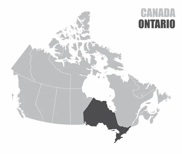
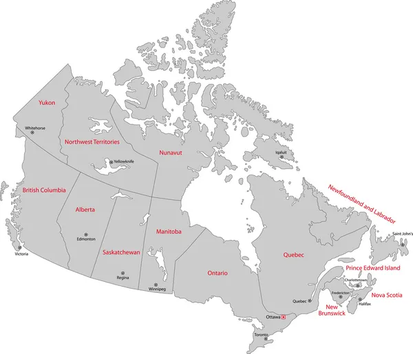
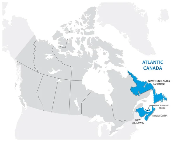
Stock vector Survey map of the four Canadian Atlantic States, Atlantic canada
Published: Nov.04, 2016 11:44:25
Author: Lesniewski
Views: 201
Downloads: 9
File type: vector / eps
File size: 0.95 MB
Orginal size: 3793 x 3100 px
Available sizes:
Level: bronze