Home
Images
Vectors
Videos
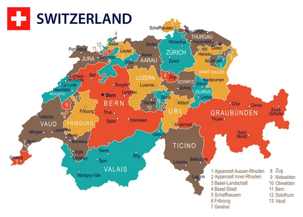
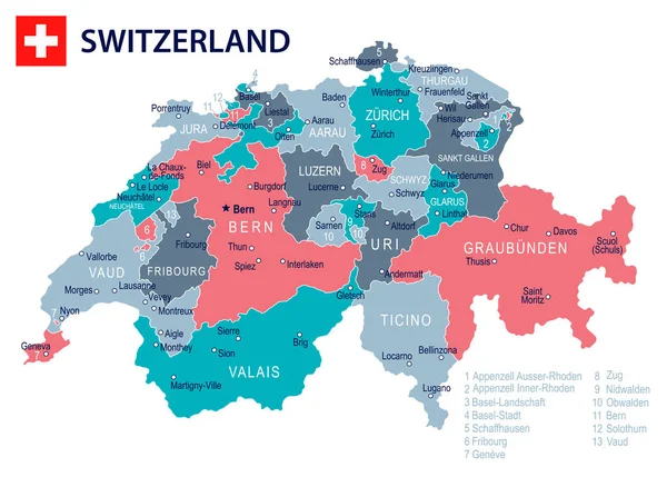
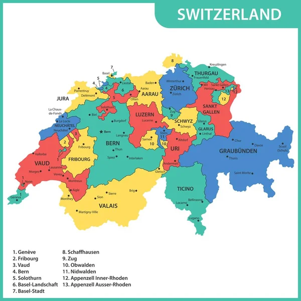
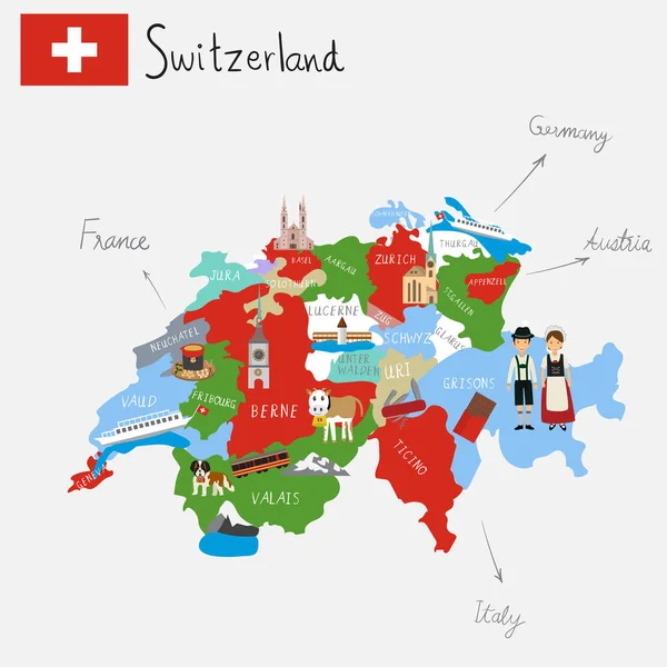
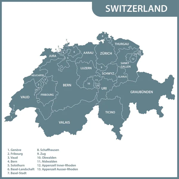
Stock vector Switzerland vector map showing cantonal, districts and municipal boundaries. Map colored by cantons and inside each canton by distrcts. Flag of Switzerland. Navigation and location icons
Published:
Jan.02, 2020 10:08:03
Author:
Jktu_21
Views:
204
Downloads:
4
File type:
vector
/
eps
File size:
24.67 MB
Orginal size:
8333
x
8333
px
Available sizes:
S
(500 x 500)
M
(1000 x 1000)
L
(2000 x 2000)
XL
(8333 x 8333)
VECT
(8333 x 8333)
EL0
(8333 x 8333)
Level:
silver
Download Vector
Vector topics:
Vector
Background
Graphic
Illustration
Shape
Swiss
Travel
Switzerland
Europe
Country
District
Map
Cartography
Geography
National
Land
State
Location
Borders
Administrative
Region
Division
Boundaries
Nation
Regional
Basel
ZUG
Vaud
Canton
Geneva
Bern
Luzern
Ticino
Valais
Schaffhausen
Glarus
Schwyz
Uri
Appenzell
Jura
Thurgau
Fribourg
Neuchatel
Aargau
Nidwalden
Solothurn
Obwalden
Infographic
St Gallen
Similar stock vectors
Switzerland - Map And Flag Illustration
8245 × 5900
Switzerland - Map And Flag Illustration
8245 × 5900
The Detailed Map Of The Switzerland With Regions Or States And Cities, Capitals
6500 × 6500
Hand Drawing Switzerlamd Maps With Hand Lettering.illustration.
5000 × 5000
Hand Drawing Switzerlamd Maps With Hand Lettering.illustration.
5000 × 5000
The Detailed Map Of The Switzerland With Regions Or States
6000 × 6000
Detailed Switzerland Administrative Map With Country Flag And Location On A Blue Globe.
7398 × 5351