Home
Images
Vectors
Videos
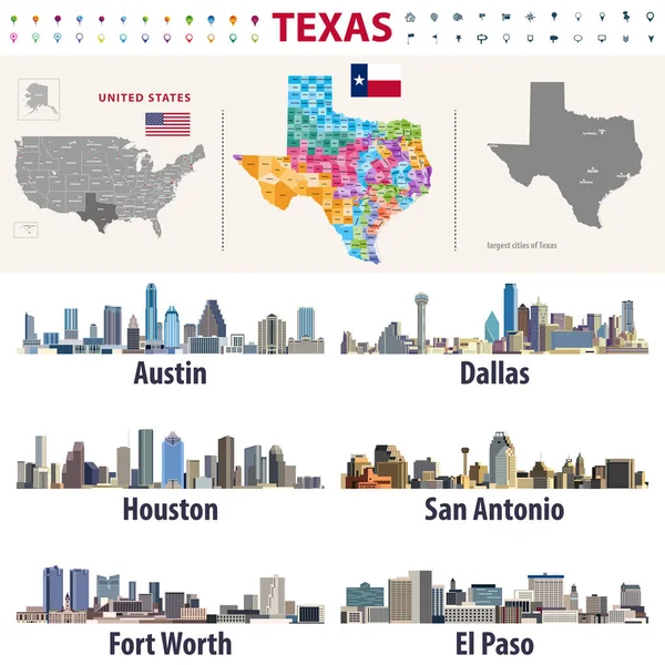
Stock vector Texas's vector high detailed map showing counties formations. Largest cities skylines of Texas
Published:
Jun.14, 2018 07:25:21
Author:
Jktu_21
Views:
98
Downloads:
17
File type:
vector
/
eps
File size:
12.33 MB
Orginal size:
8333
x
8333
px
Available sizes:
S
(500 x 500)
M
(1000 x 1000)
L
(2000 x 2000)
XL
(8333 x 8333)
VECT
(8333 x 8333)
EL0
(8333 x 8333)
Level:
silver
Download Vector
Vector topics:
Vector
Background
Illustration
Design
Travel
Silhouette
Border
Flag
Modern
Architecture
City
Skyscraper
Tower
Urban
Usa
Tourism
Cityscape
Skyline
South
Country
District
Map
Cartography
Geography
Buildings
State
Texas
America
Political
Administrative
Austin
Houston
Dallas
Congressional
United States
Fort Worth
San Antonio
El Paso
Similar stock vectors
Set Of Flat City Silhouettes, Simple Vector Illustration
5362 × 5484
Set Of Flat City Silhouettes, Simple Vector Illustration
2681 × 2742
Gold Square Mosaic Map Of Texas State
5656 × 3316
Texas Map Collection Of Map Of Texas In Dotted Style Borders Of The Us State Filled With
5119 × 5863
Texas El Paso Architecture Line Skyline Illustration. Linear Vector Cityscape With Famous Landmarks, City Sights, Design Icons. Landscape Wtih Editable Strokes
6000 × 3000
Usa, Texas El Paso Architecture Vector City Skyline, Travel Cityscape With Landmarks, Buildings, Isolated Sights On Background
4000 × 2000
Texas Map Us State Poster With Regions Old Grunge Texture Shape Of Texas With Us State Name
5209 × 5782