Home
Images
Vectors
Videos
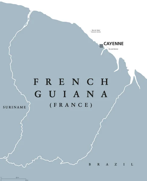
Stock vector The French Guiana map divided in regions with labels
Published:
Sep.24, 2020 10:18:33
Author:
luisrftc
Views:
3
Downloads:
0
File type:
vector
/
eps
File size:
8.15 MB
Orginal size:
4164
x
5000
px
Available sizes:
S
(416 x 500)
M
(833 x 1000)
L
(1666 x 2000)
XL
(4164 x 5000)
VECT
(4164 x 5000)
EL0
(4164 x 5000)
Level:
bronze
Download Vector
Vector topics:
Vector
Graphic
Illustration
Design
Isolated
Shape
New
Travel
Abstract
Black
French
Silhouette
Border
Modern
Symbol
Icon
City
Saint
Flat
Contour
Simple
Point
Outline
Country
Map
Cartography
Geography
Area
National
Trip
Cayenne
State
Scheme
Administrative
Geographic
Department
Region
Division
Nation
County
Regional
Districts
Provinces
Guiana
Laurent
Guyane
Maroni
Saint Laurent Du Maroni
Guianian
Similar stock vectors
Vector Abstract Hatched Map Of French Guiana With Oblique Lines Isolated On A White Background. Travel Vector Illustration.
5000 × 5000
Vector Dotted Map Of French Guiana Isolated On White Background . Travel Vector Illustration
5000 × 5000
French Guiana Map Black And White Vector Illustration.
8334 × 8334
Vector Pixel Map Of French Guiana Isolated On White Background . Travel Vector Illustration
5000 × 5000
Highly Detailed French Guiana Map With Borders Isolated On Background
4000 × 6000
Vector Abstract Hatched Map Of French Guiana With Zig Zag Lines Isolated On A White Background.
5000 × 5000
French Guiana Political Map
7204 × 8888