Home
Images
Vectors
Videos
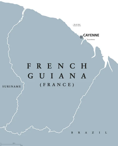
Stock vector The Guianas, also Guyanas or Guayanas, political map. Region in north-eastern South America compromising the Guayana Region of Venezuela, Guyana, Suriname, French Guiana and the Amapa state of Brazil.
Published:
Jun.26, 2024 06:44:44
Author:
Furian
Views:
1
Downloads:
0
File type:
vector
/
eps
File size:
1.32 MB
Orginal size:
9000
x
6000
px
Available sizes:
S
(500 x 333)
M
(1000 x 667)
L
(2000 x 1333)
XL
(9000 x 6000)
VECT
(9000 x 6000)
EL0
(9000 x 6000)
Level:
silver
Download Vector
Vector topics:
Colors
Vector
Colored
Illustration
Isolated
Travel
French
Border
France
Northern
Country
Map
Cartography
Geography
Continent
Overview
America
Boundary
Political
Atlantic
Region
Brazil
British
Spanish
Atlas
Americas
Dutch
Mapping
Brazilian
Geographical
Venezuela
Portuguese
Colombia
Guyana
Suriname
Venezuelan
North Eastern
Infographic
Multi Colored
Caribbean Sea
South America
Amapa
Guianas
French Guiana
Overseas Department
Amapa State
Guyanas
Guayanas
The Guianas
Guayana Region
Similar stock vectors
Guyana Country Detailed Editable Map
4790 × 6000
Guyana Highly Detailed Vector Map With Administrative Regions, Main Cities And Roads.
4032 × 5000
Guyana Map
7000 × 7000
Suriname Political Map
7806 × 8222
Guyana Political Map
7229 × 8777
Map Of South America With All Countries
4000 × 5000
French Guiana Political Map
7204 × 8888
Red Star Pattern Map Of Guyana
4778 × 3349