Home
Images
Vectors
Videos
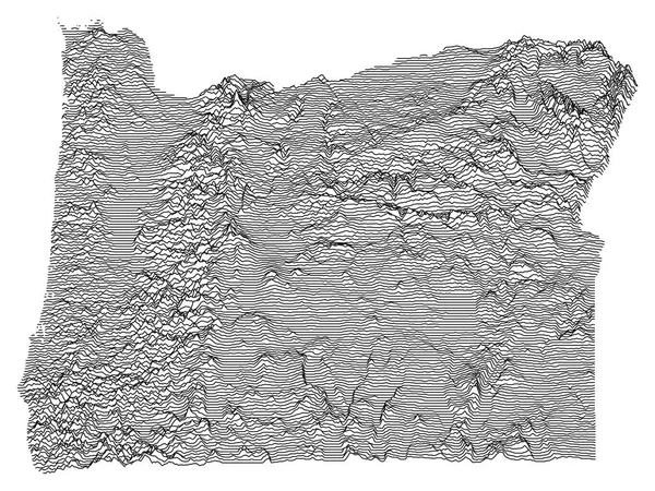
Stock vector Topographic Relief Peaks and Valleys Map of US Federal State of Oregon
Published:
Nov.06, 2020 11:31:03
Author:
momcilo.jovanov
Views:
4
Downloads:
1
File type:
vector
/
eps
File size:
3.36 MB
Orginal size:
4800
x
3600
px
Available sizes:
S
(500 x 375)
M
(1000 x 750)
L
(2000 x 1500)
XL
(4800 x 3600)
VECT
(4800 x 3600)
EL0
(4800 x 3600)
Level:
bronze
Download Vector
Vector topics:
Color
Vector
Background
Illustration
Labeling
Travel
Mountain
Line
Silhouette
Border
Pastel
Contour
Usa
Relief
Outline
Hill
District
Map
Cartography
Geography
State
Topography
Unity
Democracy
Region
Valley
Election
Geographical
2020
Trump
Topographic
Counties
Biden
Constituency
Clip Art
Travel Destinations
Residential District
Star Shape
Famous Place
United States Of America
US State Border
Frame Border
Ellectors
Similar stock vectors
Topographic Relief Peaks And Valleys Map Of US Federal State Of Pennsylvania
4800 × 3600
Topographic Relief Peaks And Valleys Map Of US Federal State Of North Dakota
4800 × 3600
Gray 3D Topography Map Of European Country Of Latvia
4800 × 3600
Light Topographic Map Of The Federal State Of Arizona, USA With Black Contour Lines On Beige Background
4500 × 5500
Gray Topographic Relief Map Of European Country Of Czech Republic
4800 × 3600
Black And White 3D Contour Topography Map Of Asian Country Of Iran
4800 × 3600
Topographic Relief Peaks And Valleys Map Of US Federal State Of Nevada
3600 × 4800
Black And White 3D Contour Topography Map Of Italian Region Of Molise
4800 × 3600