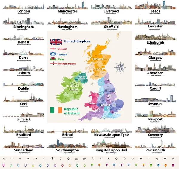
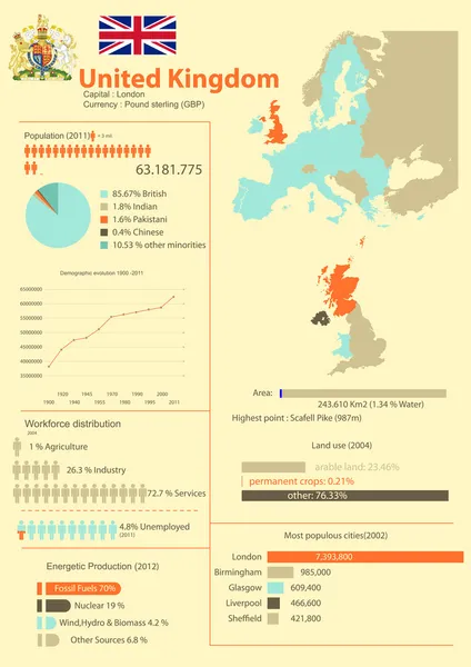
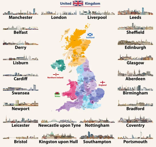
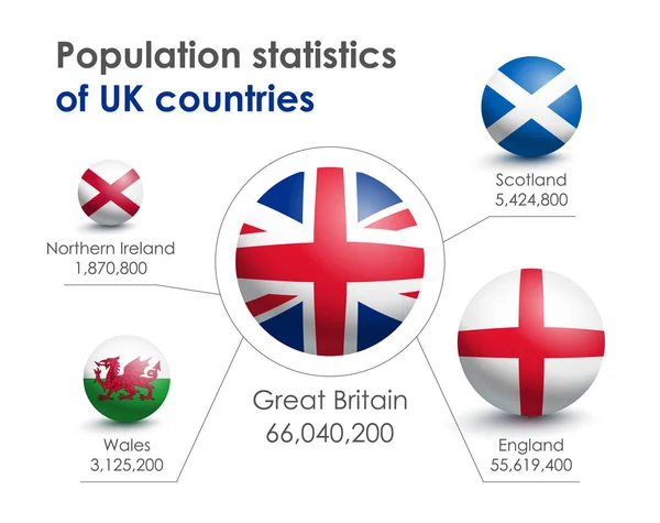
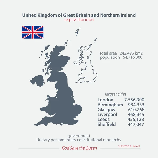
Stock vector United Kingdom of Great Britain and Northern Ireland maps and official flag icon. vector British political map icons and general information. EU geographic banner template. business concept map
Published: Jun.15, 2016 12:52:41
Author: metrue
Views: 310
Downloads: 5
File type: vector / eps
File size: 0.68 MB
Orginal size: 4000 x 4000 px
Available sizes:
Level: bronze