Home
Images
Vectors
Videos
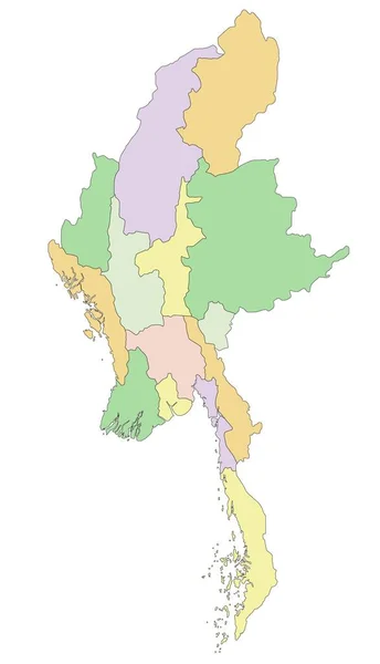
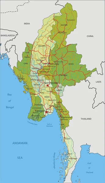
Stock vector Vector illustrated blank map of Myanmar with regions, states and administrative divisions, and neighbouring countries and territories. Editable and clearly labeled layers.
Published:
Jul.12, 2024 19:25:40
Author:
asantosg
Views:
0
Downloads:
0
File type:
vector
/
eps
File size:
4.21 MB
Orginal size:
3600
x
5400
px
Available sizes:
S
(333 x 500)
M
(667 x 1000)
L
(1333 x 2000)
XL
(3600 x 5400)
VECT
(3600 x 5400)
EL0
(3600 x 5400)
Level:
bronze
Download Vector
Vector topics:
Color
White
Vector
Background
Colorful
Graphic
Illustration
Design
Isolated
Sea
Blank
Physical
Information
Ocean
Detailed
Illustrated
Country
Map
Cartography
Geography
National
Asia
Borders
Layers
Political
Administrative
States
Division
Info
English
Editable
Southeast
Mockup
Regional
Shan
Myanmar
Provinces
Regions
Burma
Territories
Labeled
Yangon
Ayeyarwady
Mandalay
Sagaing
Infographics
Neighbouring
Rakhine
Kachin
Tanintharyi
Similar stock vectors
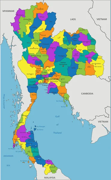
Colorful Thailand Political Map With Clearly Labeled, Separated Layers. Vector Illustration.
2814 × 4556
Myanmar - Highly Detailed Editable Political Map.
2072 × 3609
Myanmar
2655 × 5055
Map Of Nicaragua
7001 × 5912
Colorful Myanmar Political Map With Clearly Labeled, Separated Layers. Vector Illustration.
2074 × 3611
Vector Illustrated Map Of Turkey With Regions And Geographical Divisions, And Neighbouring Countries. Editable And Clearly Labeled Layers.
6000 × 4000
Highly Detailed Editable Political Map With Separated Layers. Myanmar.
2072 × 3609
Political Color Map Of Southeast Asia With Borders Of The States.
4667 × 4000