Home
Images
Vectors
Videos
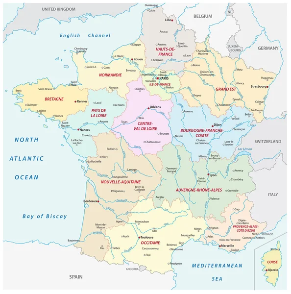
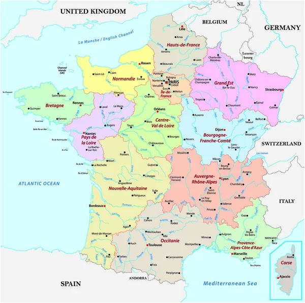
Stock vector vector map France with the regions, rivers and the most important cities
Published:
Dec.14, 2021 07:08:56
Author:
PantherMediaSeller
Views:
111
Downloads:
1
File type:
vector
/
zip
File size:
0 MB
Orginal size:
4000
x
3995
px
Available sizes:
S
(500 x 499)
M
(1000 x 999)
L
(2000 x 1998)
XL
(4000 x 3995)
VECT
(4000 x 3995)
EL0
(4000 x 3995)
Level:
platinum
Download Vector
Vector topics:
Vector
River
City
With
France
Map
Important
Paris
Region
The
Cities
And
Most
Rivers
Regions
Similar stock vectors
Vector Outline Map Of Main French Regional Languages
4000 × 3955
France Map - Vintage Vector Illustration
5500 × 5736
France Map With The New Regions And The Most Important Cities And Rivers
3100 × 3131
Colorful Belgium Political Map With Clearly Labeled, Separated Layers. Vector Illustration.
5408 × 4257
Highly Detailed Editable Political Map With Separated Layers. France.
4791 × 4652
Slovenia Map - High Detailed Vector Illustration
7281 × 5500
Administrative And Political Vector Map Grand Duchy Of Luxembourg
3709 × 4000
Map Of Germany With All Cities Over One Hundred Thousand Inhabitants In German Language
3717 × 4000