Home
Images
Vectors
Videos
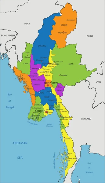
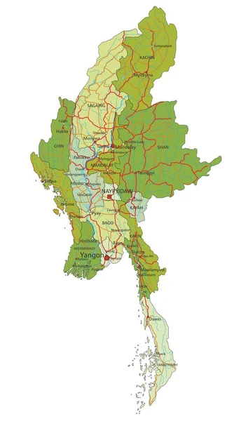
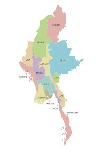
Stock vector Vector map of Myanmar with regions, states and administrative divisions. Editable and clearly labeled layers.
Published:
Jul.12, 2024 19:25:40
Author:
asantosg
Views:
0
Downloads:
0
File type:
vector
/
eps
File size:
2.34 MB
Orginal size:
3600
x
5400
px
Available sizes:
S
(333 x 500)
M
(667 x 1000)
L
(1333 x 2000)
XL
(3600 x 5400)
VECT
(3600 x 5400)
EL0
(3600 x 5400)
Level:
bronze
Download Vector
Vector topics:
Color
White
Vector
Background
Colorful
Graphic
Illustration
Design
Isolated
Physical
Information
Detailed
Country
Map
Cartography
Geography
National
Asia
Borders
Layers
Political
Administrative
States
Division
Info
English
Editable
Southeast
Mockup
Regional
Shan
Myanmar
Provinces
Regions
Burma
Territories
Labeled
Yangon
Ayeyarwady
Mandalay
Sagaing
Infographics
Neighbouring
Rakhine
Kachin
Tanintharyi
Similar stock vectors
Pastel Colored Labeled Flat Provinces Map Of The Asian Country Of Thailand
3600 × 4800
Multicolor Map Of Myanmar With Provinces
2401 × 2401
Colorful Myanmar Political Map With Clearly Labeled, Separated Layers. Vector Illustration.
2074 × 3611
Highly Detailed Editable Political Map With Separated Layers. Myanmar.
2072 × 3609
Myanmar Map Color Line Element. Border Of The Country.
5209 × 5210
The Administrative Map Of Myanmar Isolated On White Background
3000 × 5000
Map Of Cambodia - Highly Detailed Vector Illustration
5252 × 4208
3d Isometric Map Of Veraguas Is A Province Of Panama Isolated With Shadow
4000 × 4000