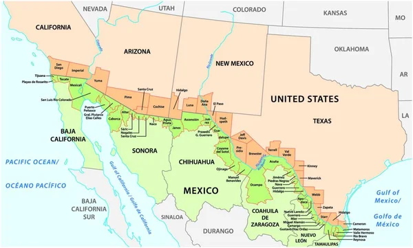
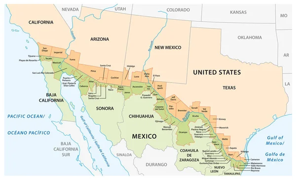
Stock vector Vector map of the border districts in the United States and Mexico along the border
Published: May.08, 2020 12:51:06
Author: Lesniewski
Views: 581
Downloads: 4
File type: vector / eps
File size: 1.17 MB
Orginal size: 5067 x 3100 px
Available sizes:
Level: bronze