photo free
Home Images Vectors Videos

Stock vector Vector Map of the Geopolitical Subdivisions of the French Department of Gironde Including Arrondissements, Cantons and Municipalities as of 2022 - Nouvelle Aquitaine - France
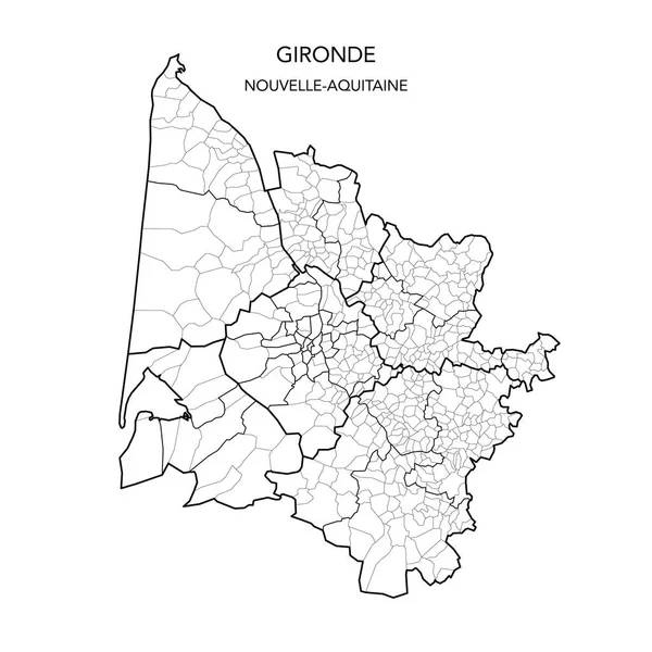
Stock vector Vector Map of the Geopolitical Subdivisions of the French Department of Gironde Including Arrondissements, Cantons and Municipalities as of 2022 - Nouvelle Aquitaine - France
Published: May.24, 2022 07:40:57
Author: Dorky
Views: 26
Downloads: 1
File type: vector / ai
File size: 1.87 MB
Orginal size: 3000 x 3000 px
Available sizes:
S
(500 x 500)
M
(1000 x 1000)
L
(2000 x 2000)
XL
(3000 x 3000)
VECT
(3000 x 3000)
EL0
(3000 x 3000)
Level: beginner
Download Vector
Vector topics:

Similar stock vectors

stock vector Vector Map of the Geopolitical Subdivisions of the French Department of Landes Including Arrondissements, Cantons and Municipalities as of 2022 - Nouvelle Aquitaine - France

Vector Map Of The Geopolitical Subdivisions Of The French Department Of Landes Including Arrondissements, Cantons And Municipalities As Of 2022 - Nouvelle Aquitaine - France

3000 × 3000
stock vector Vector Map of the Geopolitical Subdivisions of the French Department of Yonne Including Arrondissements, Cantons and Municipalities as of 2022 - Bourgogne-Franche-Comte - France

Vector Map Of The Geopolitical Subdivisions Of The French Department Of Yonne Including Arrondissements, Cantons And Municipalities As Of 2022 - Bourgogne-Franche-Comte - France

3000 × 3000
stock vector Vector Map of the Geopolitical Subdivisions of the French Department of Alpes-de-Haute-Provence Including Arrondissements, Cantons and Municipalities as of 2022 - Provence-Alpes-Cote dAzur - France

Vector Map Of The Geopolitical Subdivisions Of The French Department Of Alpes-de-Haute-Provence Including Arrondissements, Cantons And Municipalities As Of 2022 - Provence-Alpes-Cote DAzur - France

3000 × 3000
stock vector Vector Map of the Geopolitical Subdivisions of the French Department of Loire Including Arrondissements, Cantons and Municipalities as of 2022 - Auvergne Rhone Alpes - France

Vector Map Of The Geopolitical Subdivisions Of The French Department Of Loire Including Arrondissements, Cantons And Municipalities As Of 2022 - Auvergne Rhone Alpes - France

3000 × 3000
stock vector Vector Map of the Geopolitical Subdivisions of the French Department of Haute-Saone Including Arrondissements, Cantons and Municipalities as of 2022 - Bourgogne-Franche-Comte - France

Vector Map Of The Geopolitical Subdivisions Of The French Department Of Haute-Saone Including Arrondissements, Cantons And Municipalities As Of 2022 - Bourgogne-Franche-Comte - France

3000 × 3000
stock vector Vector Map of the Geopolitical Subdivisions of the French Department of Saone-et-Loire Including Arrondissements, Cantons and Municipalities as of 2022 - Bourgogne-Franche-Comte - France

Vector Map Of The Geopolitical Subdivisions Of The French Department Of Saone-et-Loire Including Arrondissements, Cantons And Municipalities As Of 2022 - Bourgogne-Franche-Comte - France

3000 × 3000
stock vector Vector Map of the Geopolitical Subdivisions of the French Department of Gard Including Arrondissements, Cantons and Municipalities as of 2022 - Occitanie - France

Vector Map Of The Geopolitical Subdivisions Of The French Department Of Gard Including Arrondissements, Cantons And Municipalities As Of 2022 - Occitanie - France

3000 × 3000
stock vector Vector Map of the Geopolitical Subdivisions of the French Department of Indre-et-Loire Including Arrondissements, Cantons and Municipalities as of 2022 - Centre-Val de Loire

Vector Map Of The Geopolitical Subdivisions Of The French Department Of Indre-et-Loire Including Arrondissements, Cantons And Municipalities As Of 2022 - Centre-Val De Loire

3000 × 3000