photo free
Home Images Vectors Videos

Stock vector Vector Map of the Geopolitical Subdivisions of the French Department of Rhone with Lyon Including Arrondissements, Cantons, Municipalities and Arrondissements De Lyon as of 2022 - Auvergne-Rhone-Alpes - France
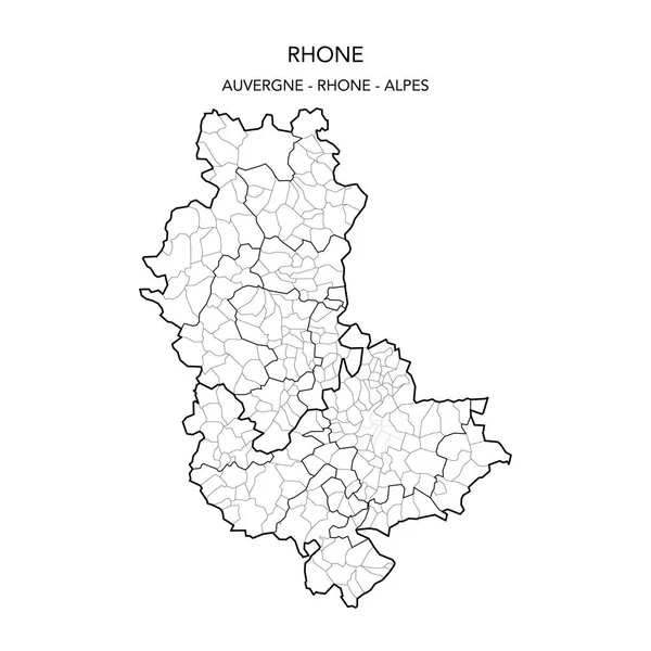
Stock vector Vector Map of the Geopolitical Subdivisions of the French Department of Rhone with Lyon Including Arrondissements, Cantons, Municipalities and Arrondissements De Lyon as of 2022 - Auvergne-Rhone-Alpes - France
Published: May.24, 2022 07:41:07
Author: Dorky
Views: 5
Downloads: 0
File type: vector / ai
File size: 1.54 MB
Orginal size: 3000 x 3000 px
Available sizes:
S
(500 x 500)
M
(1000 x 1000)
L
(2000 x 2000)
XL
(3000 x 3000)
VECT
(3000 x 3000)
EL0
(3000 x 3000)
Level: beginner
Download Vector
Vector topics:

Similar stock vectors

stock vector Vector Map of the Geopolitical Subdivisions of the French Department of Loire Including Arrondissements, Cantons and Municipalities as of 2022 - Auvergne Rhone Alpes - France

Vector Map Of The Geopolitical Subdivisions Of The French Department Of Loire Including Arrondissements, Cantons And Municipalities As Of 2022 - Auvergne Rhone Alpes - France

3000 × 3000
stock vector Vector Map of the Geopolitical Subdivisions of the French Department of Isere Including Arrondissements, Cantons and Municipalities as of 2022 - Auvergne Rhone Alpes - France

Vector Map Of The Geopolitical Subdivisions Of The French Department Of Isere Including Arrondissements, Cantons And Municipalities As Of 2022 - Auvergne Rhone Alpes - France

3000 × 3000
stock vector Vector Map of the Geopolitical Subdivisions of the French Department of Savoie Including Arrondissements, Cantons and Municipalities as of 2022 - Auvergne Rhne Alpes - France

Vector Map Of The Geopolitical Subdivisions Of The French Department Of Savoie Including Arrondissements, Cantons And Municipalities As Of 2022 - Auvergne Rhne Alpes - France

3000 × 3000
stock vector Auvergne-Rhone-Alpes administrative map divided in departments with labels, France

Auvergne-Rhone-Alpes Administrative Map Divided In Departments With Labels, France

5000 × 3858
stock vector High Quality map region of France

High Quality Map Region Of France

4000 × 4000
stock vector Vector Map of the Geopolitical Subdivisions of the French Department of Allier Including Arrondissements, Cantons and Municipalities as of 2022 - Auvergne-Rhone-Alpes - France

Vector Map Of The Geopolitical Subdivisions Of The French Department Of Allier Including Arrondissements, Cantons And Municipalities As Of 2022 - Auvergne-Rhone-Alpes - France

3000 × 3000
stock vector Vector Map of the Geopolitical Subdivisions of the French Department of Aisne Including Arrondissements, Cantons and Municipalities as of 2022 - Hauts-de-France - France

Vector Map Of The Geopolitical Subdivisions Of The French Department Of Aisne Including Arrondissements, Cantons And Municipalities As Of 2022 - Hauts-de-France - France

3000 × 3000
stock vector simple gray administrative map of the new french region Auvergne Rhone Alpes

Simple Gray Administrative Map Of The New French Region Auvergne Rhone Alpes

4000 × 3848