Home
Images
Vectors
Videos
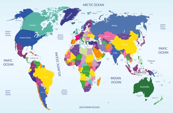
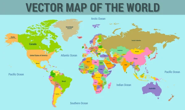
Stock vector Vector map of the world with the names of the countries, with the borders of the countries.
Published:
Jan.02, 2023 23:01:12
Author:
rp_pro
Views:
12
Downloads:
1
File type:
vector
/
eps
File size:
2.63 MB
Orginal size:
5000
x
3000
px
Available sizes:
S
(500 x 300)
M
(1000 x 600)
L
(2000 x 1200)
XL
(5000 x 3000)
VECT
(5000 x 3000)
EL0
(5000 x 3000)
Level:
beginner
Download Vector
Vector topics:
Green
Color
Red
Yellow
Blue
Vector
Brown
Sea
River
City
Education
Earth
Usa
Grid
Relief
Detailed
Europe
China
Russia
Country
Map
Africa
Land
Height
Asia
Layer
Countries
Australia
Boundary
Political
Depth
States
Continents
Oceania
Territory
Antarctica
Middle East
World Map
Illustration And Painting
North America
South America
Information Medium
Mediterranean Sea
Pacific Ocean
The Americas
Atlantic Ocean
Navigational Equipment
Similar stock vectors
Illustration With The Geographical Map Of Tectonic Plates
7209 × 5134
Infographic Worl Map
6250 × 4167
World Geographical And Political Map
7569 × 4949
World Map With Ocean
4686 × 3264
Business Map Set 6
6973 × 5000
World Map Vintage Political - Vector Illustration - Layers
6001 × 3669
World Map Showing Tectonic Plates Boundaries Illustration
6599 × 3367