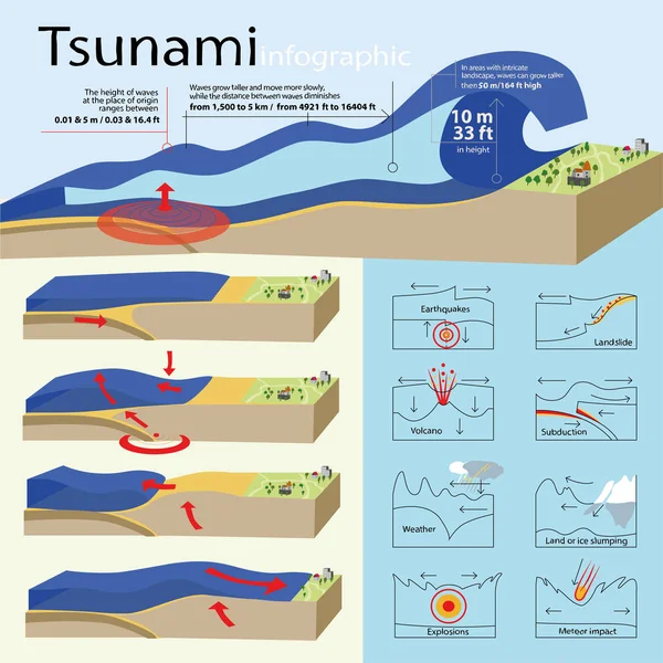
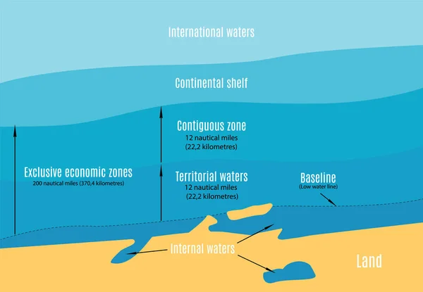
Stock vector Vector schematic map of the sea areas in international rights. (Top view).
Published: Jun.15, 2020 12:10:27
Author: Faraoshka
Views: 2
Downloads: 0
File type: vector / eps
File size: 5.39 MB
Orginal size: 5780 x 4000 px
Available sizes:
Level: beginner