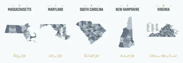
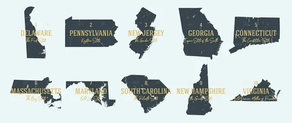
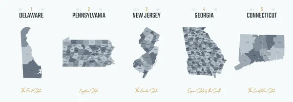
Stock vector Vector set 1 of 10 Highly detailed silhouettes of US state maps, divided into counties with names and territory nicknames
Published: Nov.22, 2021 13:55:59
Author: Max_776
Views: 0
Downloads: 0
File type: vector / eps
File size: 3.86 MB
Orginal size: 9584 x 3348 px
Available sizes:
Level: bronze