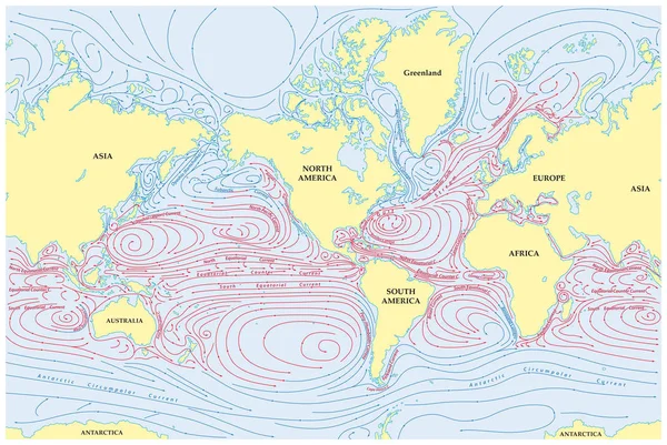
Stock vector Vector world map of all sea currents
Published: Mar.02, 2017 16:16:45
Author: Lesniewski
Views: 540
Downloads: 19
File type: vector / eps
File size: 4.22 MB
Orginal size: 4630 x 3100 px
Available sizes:
Level: bronze