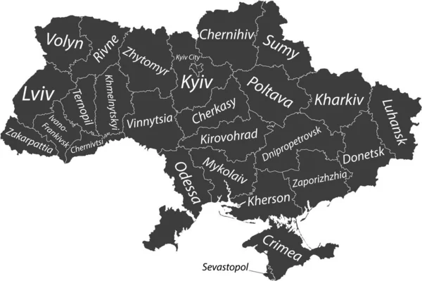
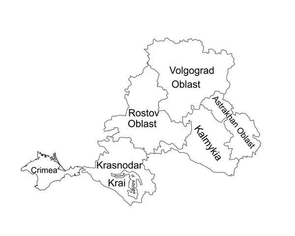
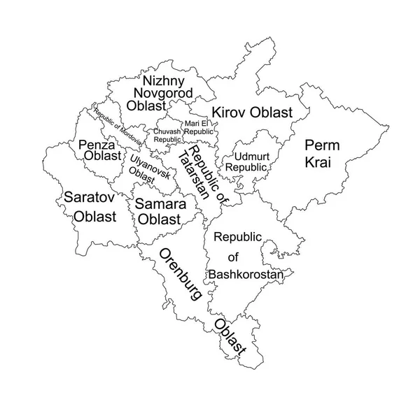
Stock vector Volga federal district map vector silhouette illustration isolated on white background. Russian federation province. Privolzhsky federal district map. Volga line contour district map.
Published: May.30, 2022 10:24:18
Author: Dovla982
Views: 12
Downloads: 0
File type: vector / eps
File size: 0.94 MB
Orginal size: 5001 x 4739 px
Available sizes:
Level: bronze