Home
Images
Vectors
Videos
Stock vector West South Central states, multi colored political map. United States Census division of the South region, consisting of the states Arkansas, Louisiana, Oklahoma, and Texas. Illustration. Vector
Published:
Jun.20, 2024 09:45:21
Author:
Furian
Views:
1
Downloads:
0
File type:
vector
/
eps
File size:
0.72 MB
Orginal size:
6423
x
6000
px
Available sizes:
S
(500 x 467)
M
(1000 x 934)
L
(2000 x 1868)
XL
(6423 x 6000)
VECT
(6423 x 6000)
EL0
(6423 x 6000)
Level:
silver
Download Vector
Vector topics:
Color
Group
Vector
Colorful
Colored
Illustration
Isolated
Silhouette
Border
Data
Contour
American
Us
Usa
Coast
Profile
South
System
Outline
Country
Map
Geography
Area
Overview
State
Texas
America
Boundary
Political
Administrative
Statistics
Geographic
States
Region
Division
Southern
Classification
Atlas
Subdivision
Mapping
Arkansas
Louisiana
Oklahoma
Census
Infographic
Multi Colored
Gulf Coast
United States
South Central
West South Central
Similar stock vectors
West South Central States, Gray Political Map. United States Census Division Of The South Region, Consisting Of The States Arkansas, Louisiana, Oklahoma, And Texas. Illustration. Vector
6423 × 6000
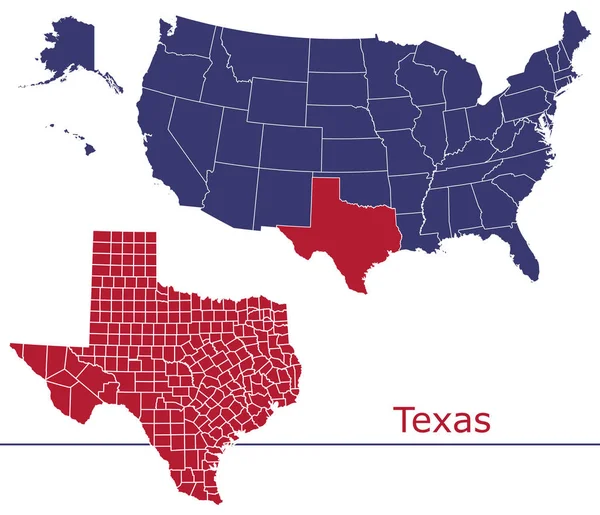
High Quality Map Of West South Central Division Of United States Of America With Borders Of The States
4000 × 4000
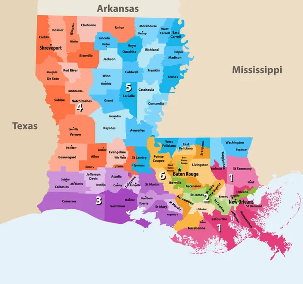
Colorful Louisiana Political Map With Clearly Labeled, Separated Layers. Vector Illustration.
5037 × 4650
U.S. States - Map Of Texas. Hand Made. Rivers And Lakes Are Shown. Please Look At My Other Images Of Cartographic Series - They Are All Very Detailed And Carefully Drawn By Hand WITH RIVERS AND LAKES.
7000 × 7000
Louisiana's Congressional Districts Vector High Detailed Map With Regions And Major Cities Names
8333 × 7824
Texas - Louisiana - Mississippi - Alabama - Florida Map Labelled
9518 × 5000
Blue Map Of Texas
4000 × 4000
Texas Counties Vector Map With USA Map Colors National Flag
4679 × 4023