Home
Images
Vectors
Videos
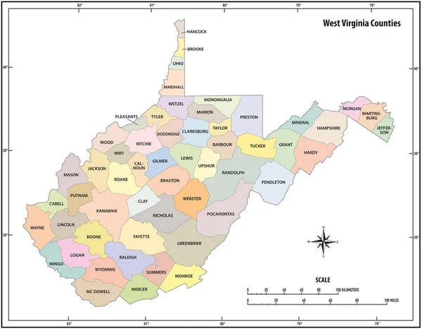
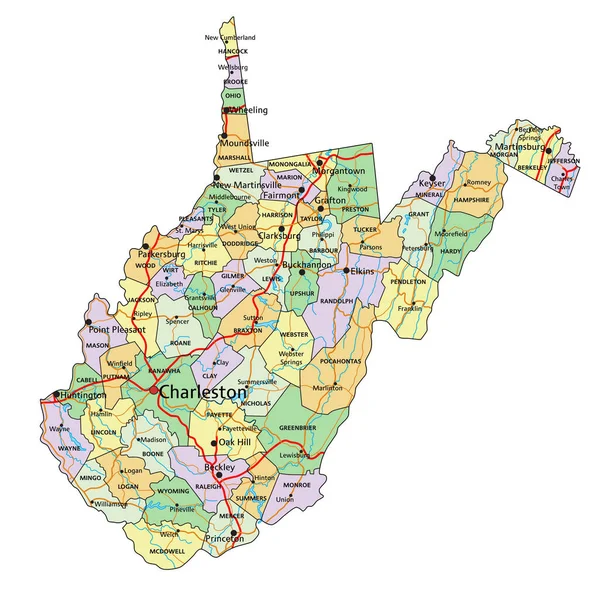
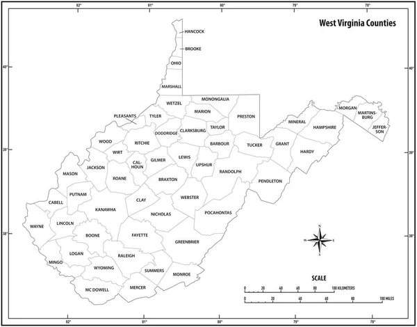
Stock vector west virginia state outline map in black and white
Published:
Apr.21, 2020 08:36:51
Author:
Lesniewski
Views:
7
Downloads:
3
File type:
vector
/
eps
File size:
0.84 MB
Orginal size:
3956
x
3100
px
Available sizes:
S
(500 x 392)
M
(1000 x 784)
L
(2000 x 1567)
XL
(3956 x 3100)
VECT
(3956 x 3100)
EL0
(3956 x 3100)
Level:
bronze
Download Vector
Vector topics:
Color
White
Vector
Graphic
Illustration
Design
Isolated
New
Travel
Abstract
Black
Border
Icon
Contour
Scale
American
Usa
Detailed
Outline
Country
District
Map
Cartography
Geography
Kilometers
State
Topography
America
Countries
Borders
Political
Administrative
United
States
Region
Miles
Nation
County
Mapping
Coordinates
Counties
North America
United States
United States Of America
Geographical Locations
West Virginia
North Arrow
Similar stock vectors
West Virginia State Outline Vector Map In Color
3956 × 3100
West Virginia State Outline Vector Map In Color
4000 × 3835
West Virginia - Highly Detailed Editable Political Map With Labeling.
3373 × 3359
Vector White Outline Map Of The Republic Of Afghanistan. State With Regional Divisions And Major Cities
8327 × 6427
Vector Contour Map Of The State Of Afghanistan. The Territory Of The Republic With Large Cities, Roads, Borders Of Regions
8327 × 6427
Shape Of Caazapa, Department Of Paraguay, With Its Capital Isolated On White Background. Colored Elevation Map. 3D Rendering
3836 × 3358
Eirunepe Municipality (Amazonas State, Municipalities Of Brazil, Federative Republic Of Brazil) Map Vector Illustration, Scribble Sketch Eirunepe Map
7087 × 4726
Large And Detailed Map Of The State Of Afghanistan.
5005 × 3753