Home
Images
Vectors
Videos
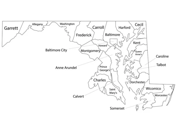
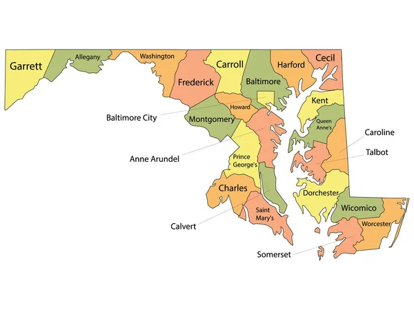
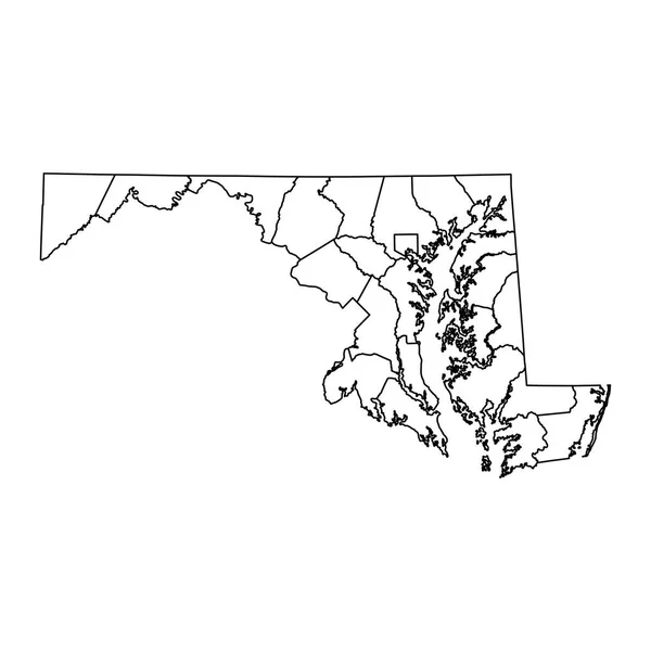
Stock vector White Outline Boroughs Map With Boroughs Names of US State of Maryland
Published:
Nov.06, 2020 11:30:17
Author:
momcilo.jovanov
Views:
1
Downloads:
0
File type:
vector
/
eps
File size:
0.65 MB
Orginal size:
4800
x
3600
px
Available sizes:
S
(500 x 375)
M
(1000 x 750)
L
(2000 x 1500)
XL
(4800 x 3600)
VECT
(4800 x 3600)
EL0
(4800 x 3600)
Level:
bronze
Download Vector
Vector topics:
Vector
Background
Illustration
Labeling
Travel
Silhouette
Border
Usa
Outline
District
Map
Cartography
State
Topography
Unity
Democracy
Region
Election
Geographical
Trump
Counties
Biden
Constituency
Clip Art
Travel Destinations
Residential District
Star Shape
Famous Place
United States Of America
US State Border
Frame Border
Ellectors
Similar stock vectors
Colorful County Map With Counties Names Of The US Federal State Of Maryland
4800 × 3600
Maryland State Map With Counties. Vector Illustration.
8334 × 8334
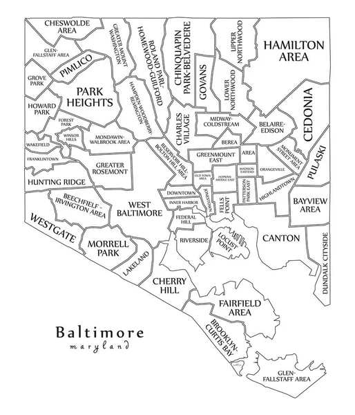
Modern City Map - Baltimore Maryland City Of The USA With Neighborhoods And Titles Outline Map
5000 × 5829
Blank Maryland State Vector Map Silhouette Illustration Isolated On White Background. High Detailed Illustration. United State Of America Empty Country. Maryland Map With County Borders.
5883 × 4031
White Vector Map Of The Federal State Of Maryland, USA With Black Borders And Names Of Its Counties
6906 × 3617
Accurate Map Of Maryland
5000 × 4000
Grey Flat Election Counties Map Of The USA Federal State Of Virginia
4800 × 3600
White Outline Counties Map Of US State Of Maryland
4800 × 3600