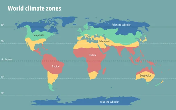
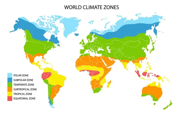
Stock vector World climate zones map, vector geographic infographics
Published: Feb.05, 2020 11:55:58
Author: SiberianArt
Views: 1484
Downloads: 18
File type: vector / eps
File size: 5.02 MB
Orginal size: 6248 x 4001 px
Available sizes:
Level: silver