Home
Images
Vectors
Videos
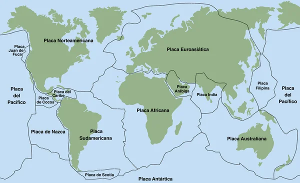
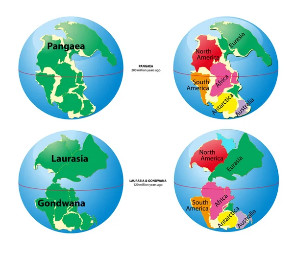
Stock vector World map of Pangaea, Laurasia, Gondwana and sea Tetis
Published:
Jun.25, 2012 11:16:15
Author:
edesignua
Views:
10929
Downloads:
53
File type:
vector
/
eps
File size:
2.36 MB
Orginal size:
4724
x
4072
px
Available sizes:
S
(500 x 431)
M
(1000 x 862)
L
(2000 x 1724)
XL
(4724 x 4072)
VECT
(4724 x 4072)
EL0
(4724 x 4072)
Level:
silver
Download Vector
Vector topics:
Vector
Years
Sea
European
Current
Old
Time
Futuristic
Age
Fingers
Earth
Planet
World
Ocean
Europe
Globe
Map
Cartography
Geography
History
Africa
Continent
Geology
Asia
Component
America
Australia
Of
The
Separated
Era
Million
Continents
And
Ladies
Maps
Atlas
Super
Cambrian
Jurassic
Ago
Before
Y
Geo
Eurasia
Worldmap
Were
Chronology
During
Was
Similar stock vectors
Plate Tectonics SPANISH TEXT
9000 × 5495
Political Map Of Continents
3827 × 2230
Samoa - Highly Detailed Black And White Map. Vector Illustration
6746 × 5251
Colombia - Highly Detailed Black And White Map. Vector Illustration
7038 × 5251
Malaysia - Highly Detailed Black And White Map. Vector Illustration
8037 × 5251
Map Of Australia
5681 × 2867
Map Of South America With Capitals In Pastel Green
5696 × 2982
Honduras - Highly Detailed Black And White Map. Vector Illustration
5462 × 5215