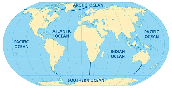
Stock vector World map of the five oceans, model of oceanic divisions with approximate boundaries. Pacific, Atlantic, Indian, Arctic, and Southern or Antarctic Ocean. Map of the world oceans, bodies of salt water.
Published: Sep.13, 2023 13:00:40
Author: Furian
Views: 145
Downloads: 1
File type: vector / eps
File size: 8.18 MB
Orginal size: 9000 x 4610 px
Available sizes:
Level: silver