photo free
Home Images Vectors Videos

Stock video States of Sudan - Geographic Maps
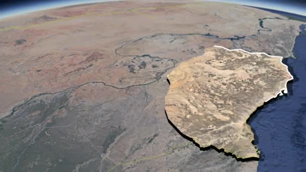
Stock video States of Sudan - Geographic Maps
Published: Apr.14, 2021 12:59:40
Author: UsulMoadib
Views: 2
Downloads: 0
File type: video / mov
File size: 221.83 MB
Orginal size: 1920 x 1080 px
Available sizes:
SMALLWEB
(320 x 240)
BIGWEB
(640 x 480)
HD720
(1280 x 720)
HD1080
(1920 x 1080)
Level: beginner
Download Video
Video topics:

Similar stock videos

stock video Airplane flying to Tehran, Iran from east, 3D animation

Airplane Flying To Tehran, Iran From East, 3D Animation

3840 × 2160
stock video Great project. Istanbul Canal is a Turkish projection for the artificial sea-level waterway, which is being built by the Turkey on the European side of Turks, connecting Black Sea to Marmara. Kanal istanbul. Seaway map mapping 3d animation strait.

Great Project. Istanbul Canal Is A Turkish Projection For The Artificial Sea-level Waterway, Which Is Being Built By The Turkey On The European Side Of Turks, Connecting Black Sea To Marmara. Kanal Istanbul. Seaway Map Mapping 3d Animation Strait.

3840 × 2160
stock video States of Sudan - Geographic Maps

States Of Sudan - Geographic Maps

1920 × 1080
stock video States of Sudan - Geographic Maps

States Of Sudan - Geographic Maps

1920 × 1080
stock video Average temperature by month in the Japan area with animated legend - raw color shader. Stereographic projection

Average Temperature By Month In The Japan Area With Animated Legend - Raw Color Shader. Stereographic Projection

1920 × 1080
stock video Map of Syria and borders, physical map Middle East, Arabian Peninsula, map with reliefs and mountains and Mediterranean Sea

Map Of Syria And Borders, Physical Map Middle East, Arabian Peninsula, Map With Reliefs And Mountains And Mediterranean Sea

3840 × 2160