
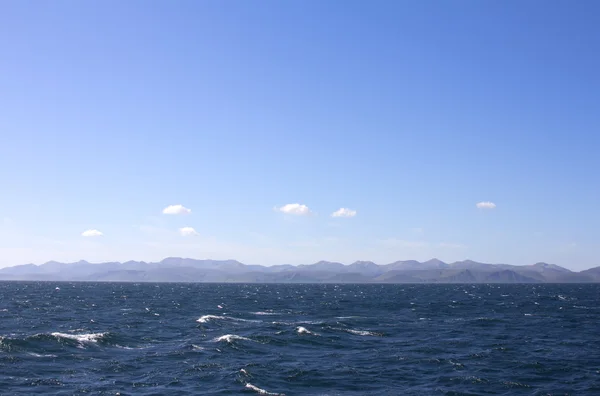
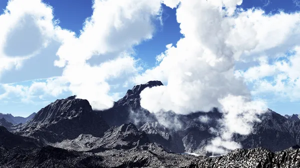
Stock image Aleutian Islands

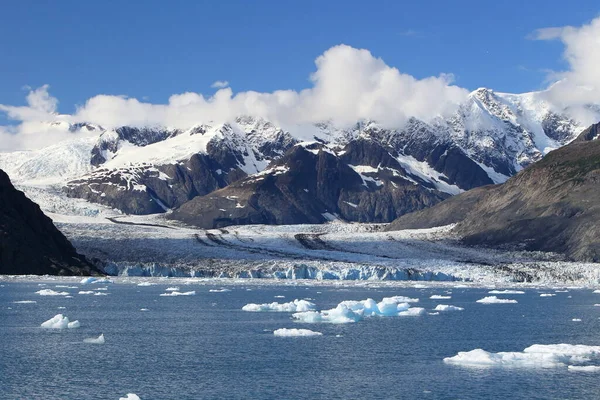
Ice And Icebergs In The Environment Of Columbia Glacier, Columbia Bay, Valdez, Alaska
Image, 11.07MB, 4896 × 3264 jpg
Ice And Icebergs In The Environment Of Columbia Glacier, Columbia Bay, Valdez, Alaska
Image, 14.39MB, 4896 × 3264 jpg

Eruption Of Cleveland Volcano, Aleutian Islands, Alaska. Elements Of This Image Furnished By Nasa
Image, 5MB, 3031 × 1923 jpg
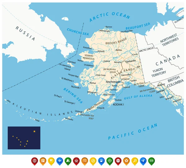
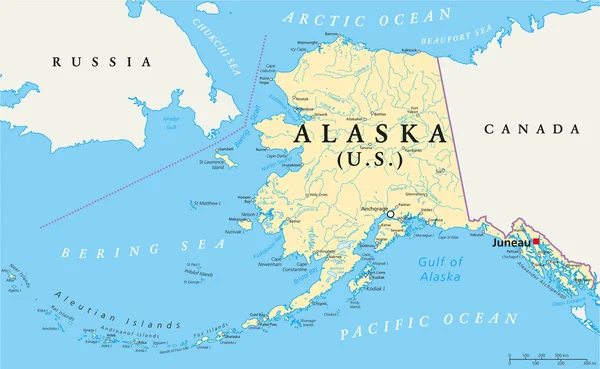
Vector Road Map Of The North American State Of Alaska, United States Of America
Vector, 2.44MB, 5449 × 3100 eps


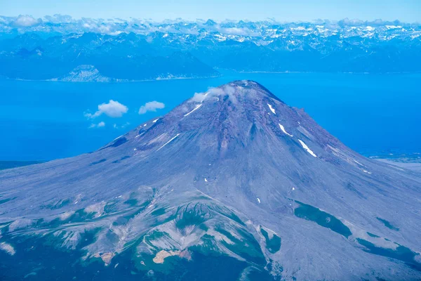
Aerial Photography View Of Augustine Volcano In Alaska's Cook Inlet On A Sunny Day
Image, 15.64MB, 5676 × 3784 jpg

Aerial Photography View Of Augustine Volcano In Alaska's Cook Inlet On A Sunny Day
Image, 13.43MB, 5662 × 3775 jpg


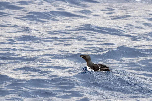
Brunnich Uria Spotted In Mediterranean Sea Ultra Rare First Sighting In 2021 In Ligurian Sea
Image, 2.41MB, 3000 × 2000 jpg


Agattu Island In The Bering Sea - Belonging To United States. Described Location Diagram With Yellow Shape Of The Island And Sample Maps Of Its Surroundings
Image, 1.84MB, 3840 × 2160 jpg

Popof Island In The Gulf Of Alaska On A Topographic, OSM Humanitarian Style Map
Image, 0.86MB, 2880 × 1620 jpg
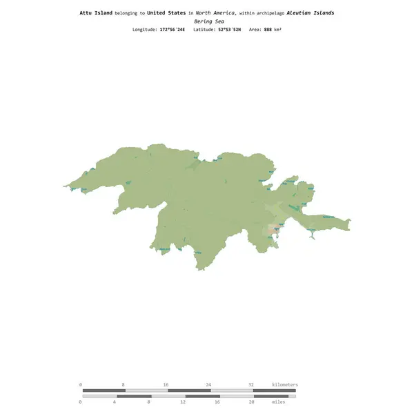
Attu Island In The Bering Sea, Belonging To United States, Isolated On A Topographic, OSM Humanitarian Style Map, With Distance Scale
Image, 0.36MB, 2160 × 2160 jpg


Buldir Island In The Bering Sea, Belonging To United States, Isolated On A Satellite Image Taken In November 11, 2020, With Distance Scale
Image, 1.13MB, 2160 × 2160 jpg

Akun Island In The Bering Sea, Belonging To United States, Isolated On A Satellite Image Taken In June 18, 2021, With Distance Scale
Image, 1.4MB, 2160 × 2160 jpg

Agattu Island In The Bering Sea, Belonging To United States, Isolated On A Bilevel Elevation Map, With Distance Scale
Image, 0.45MB, 2160 × 2160 jpg

Little Sitkin Island In The Bering Sea, Belonging To United States, Isolated On A Bilevel Elevation Map, With Distance Scale
Image, 0.4MB, 2160 × 2160 jpg

Popof Island In The Gulf Of Alaska, Belonging To United States, Isolated On A Satellite Image Taken In October 15, 2020, With Distance Scale
Image, 1.83MB, 2160 × 2160 jpg

Kiska Island In The Bering Sea On A Topographic, OSM Humanitarian Style Map
Image, 0.42MB, 2880 × 1620 jpg

Segula Island In The Bering Sea On A Topographic, OSM Humanitarian Style Map
Image, 0.22MB, 2880 × 1620 jpg

Popof Island In The Gulf Of Alaska On A Satellite Image Taken In July 15, 2021
Image, 5.82MB, 2880 × 1620 jpg

Semisopochnoi Island In The Bering Sea On A Satellite Image Taken In August 22, 2020
Image, 3.74MB, 2880 × 1620 jpg

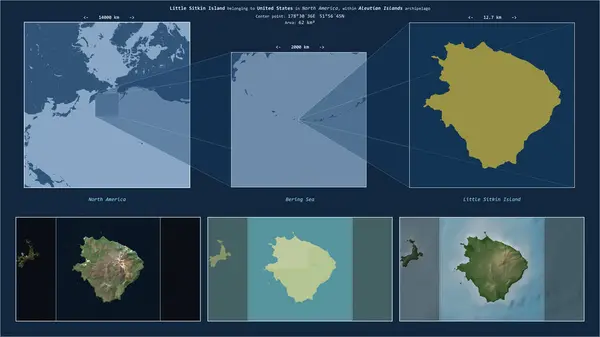
Little Sitkin Island In The Bering Sea - Belonging To United States. Described Location Diagram With Yellow Shape Of The Island And Sample Maps Of Its Surroundings
Image, 1.72MB, 3840 × 2160 jpg
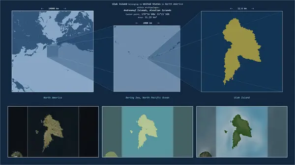
Ulak Island In The Bering Sea - Belonging To United States. Described Location Diagram With Yellow Shape Of The Island And Sample Maps Of Its Surroundings
Image, 1.99MB, 3840 × 2160 jpg

Bering Island In The Bering Sea On A Topographic, OSM Humanitarian Style Map
Image, 0.57MB, 2880 × 1620 jpg

Agattu Island In The Bering Sea On A Topographic, OSM Humanitarian Style Map
Image, 0.33MB, 2880 × 1620 jpg

Medny Island In The Bering Sea On A Satellite Image Taken In July 12, 2024
Image, 3.17MB, 2880 × 1620 jpg

Semisopochnoi Island In The Bering Sea On A Topographic, OSM Humanitarian Style Map
Image, 0.27MB, 2880 × 1620 jpg

Page 1 >> Next