photo free
Home Images Vectors Videos

Stock image Clare Map Isolated

stock vector Detailed map of Ireland with administrative divisions into provinces and counties, major cities of the country, vector illustration onwhite background

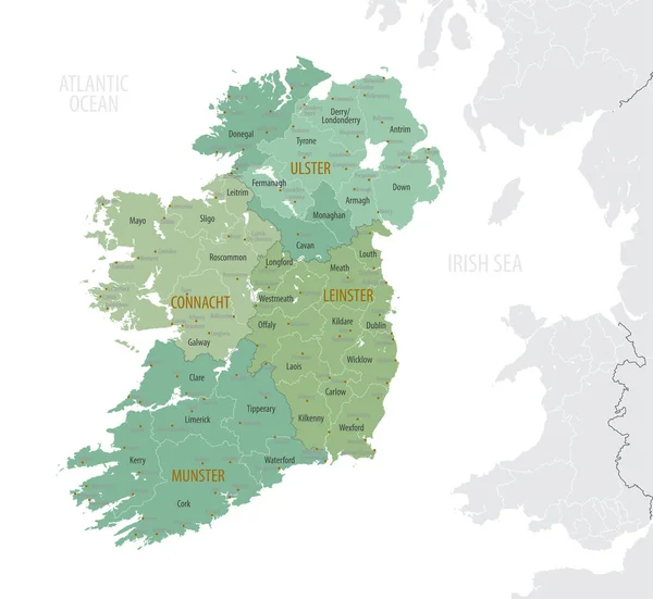
Detailed Map Of Ireland With Administrative Divisions Into Provinces And Counties, Major Cities Of The Country, Vector Illustration Onwhite Background

Vector, 4.12MB, 7087 × 6510 eps
stock vector Provinces and counties of Ireland vector map

Provinces And Counties Of Ireland Vector Map

Vector, 6.25MB, 7292 × 5126 eps
stock vector County Clare map, administrative counties of Ireland. Vector illustration.

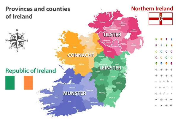
County Clare Map, Administrative Counties Of Ireland. Vector Illustration.

Vector, 5.36MB, 8334 × 8334 eps
stock image Map of Clare County in Michigan state on white background. single County map highlighted by black colour on Michigan map. UNITED STATES, US

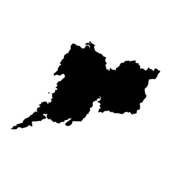
Map Of Clare County In Michigan State On White Background. Single County Map Highlighted By Black Colour On Michigan Map. UNITED STATES, US

Image, 5.31MB, 8000 × 8000 jpg
stock vector Clare and Gilbert Valleys (South Australia) outline map set

Clare And Gilbert Valleys (South Australia) Outline Map Set

Vector, 0.42MB, 6000 × 3000 eps
Page 1 >> Next