photo free
Home Images Vectors Videos

Stock image Craighead

stock vector Arkansas County Map

Arkansas County Map

Vector, 0.7MB, 5000 × 5000 ai
stock vector Arkansas map

Arkansas Map

Vector, 0.8MB, 5000 × 5000 ai
stock vector Arkansas, U.S. state, political map with borders and county names. State in the West South Central region of the Southern United States, subdivided into 75 counties, nicknamed The Natural State.

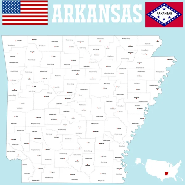
Arkansas, U.S. State, Political Map With Borders And County Names. State In The West South Central Region Of The Southern United States, Subdivided Into 75 Counties, Nicknamed The Natural State.

Vector, 3.42MB, 6000 × 6000 eps
stock vector Arkansas, U.S. state, gray political map with borders and county names. State in the West South Central region of the Southern United States, subdivided into 75 counties. Nicknamed The Natural State.

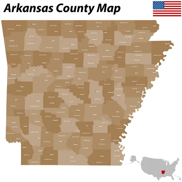
Arkansas, U.S. State, Gray Political Map With Borders And County Names. State In The West South Central Region Of The Southern United States, Subdivided Into 75 Counties. Nicknamed The Natural State.

Vector, 3.14MB, 6623 × 6000 eps
stock vector Arkansas, U.S. state, subdivided into 75 counties, multi colored political map with capital Little Rock, borders and county names. State in the West South Central region of the Southern United States.

Arkansas, U.S. State, Subdivided Into 75 Counties, Multi Colored Political Map With Capital Little Rock, Borders And County Names. State In The West South Central Region Of The Southern United States.

Vector, 3.16MB, 6623 × 6000 eps
Page 1 >> Next