photo free
Home Images Vectors Videos

Stock image East China Sea

stock vector High detail vector map of far east Asia

High Detail Vector Map Of Far East Asia

Vector, 9.12MB, 5760 × 5922 eps
stock image   Overlooking the sunset of Liugong Island from the coast of Weishan, Shandong, China.Steamers at Weihai Wharf.

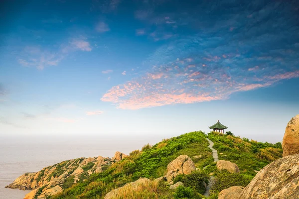
Overlooking The Sunset Of Liugong Island From The Coast Of Weishan, Shandong, China.Steamers At Weihai Wharf.

Image, 26.22MB, 7783 × 5191 jpg
stock image Chinese traditional pavilion next to lake in the Putuoshan mountains, Zhoushan Islands,  a renowned site in Chinese bodhimanda of the bodhisattva Avalokitesvara (Guanyin)

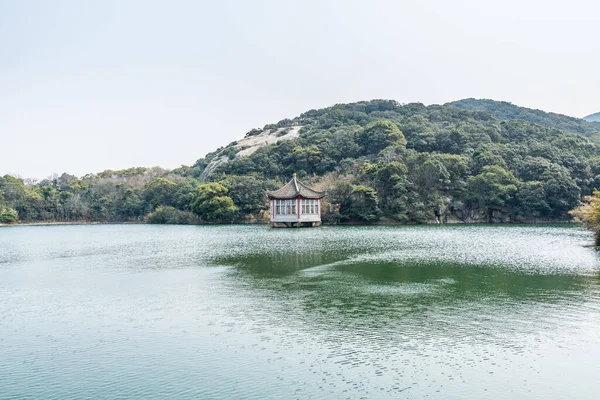
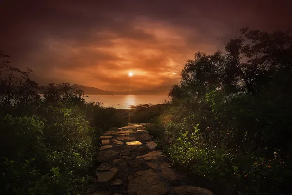
Chinese Traditional Pavilion Next To Lake In The Putuoshan Mountains, Zhoushan Islands, A Renowned Site In Chinese Bodhimanda Of The Bodhisattva Avalokitesvara (Guanyin)

Image, 12.69MB, 5968 × 3979 jpg
stock image Chinese Temple in Jiufen, Taiwan

Chinese Temple In Jiufen, Taiwan

Image, 5.25MB, 3000 × 2000 jpg
stock image east china sea in sunset

East China Sea In Sunset

Image, 8.35MB, 4500 × 3000 jpg
stock image Evening Time at the Beach

Evening Time At The Beach

Image, 1.47MB, 2165 × 2000 jpg
stock vector Vector Asia Map

Vector Asia Map

Vector, 26MB, 7349 × 5522 eps
stock vector Detailed World Map in colors of blue and 3D square pin icons

Detailed World Map In Colors Of Blue And 3D Square Pin Icons

Vector, 14.12MB, 8192 × 4609 eps
stock image The South China sea off the Vietnamese coast near  of Nha Trang.

The South China Sea Off The Vietnamese Coast Near Of Nha Trang.

Image, 17.33MB, 7360 × 4912 jpg
stock image Cargo ships, oil tankers and bulk carriers anchored offshore along the Singapore Straight, in Singapore, at sunset

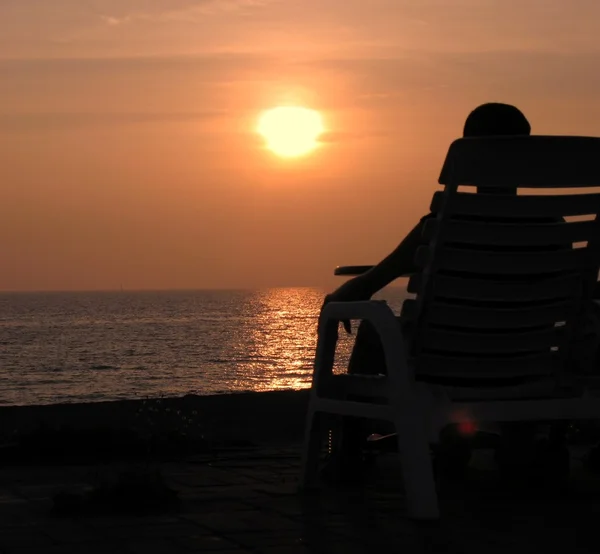
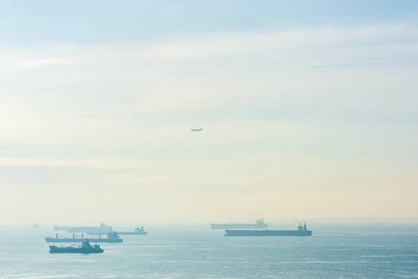
Cargo Ships, Oil Tankers And Bulk Carriers Anchored Offshore Along The Singapore Straight, In Singapore, At Sunset

Image, 7.39MB, 7360 × 4912 jpg
stock image Splash of water at China Beach in Danang in Vietnam

Splash Of Water At China Beach In Danang In Vietnam

Image, 12.18MB, 5100 × 3400 jpg
stock image The South China sea off the Vietnamese coast near  of Nha Trang.

The South China Sea Off The Vietnamese Coast Near Of Nha Trang.

Image, 16.58MB, 3337 × 5000 jpg
stock image Tianya Haijiao - Tourism Zone, China

Tianya Haijiao - Tourism Zone, China

Image, 7.38MB, 4249 × 2823 jpg
stock image Waves in sea at China Beach in Danang in Vietnam

Waves In Sea At China Beach In Danang In Vietnam

Image, 19.16MB, 6900 × 4602 jpg
stock image Mountains and Bamboo boat at China Beach in Danang Vietnam

Mountains And Bamboo Boat At China Beach In Danang Vietnam

Image, 19.36MB, 4737 × 7286 jpg
stock vector Shanghai and the Yangtze River Delta, political map with major cities. Megalopolis of China, located where the Yangtze River drains into the East China Sea, with Hangzhou Bay and Zhoushan Archipelago.

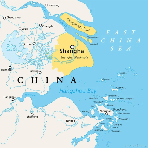
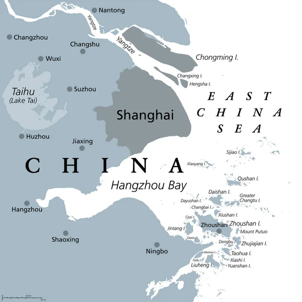
Shanghai And The Yangtze River Delta, Political Map With Major Cities. Megalopolis Of China, Located Where The Yangtze River Drains Into The East China Sea, With Hangzhou Bay And Zhoushan Archipelago.

Vector, 5.05MB, 6000 × 6000 eps
stock vector China political map with clearly labeled, separated layers. Vector illustration.

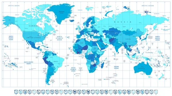
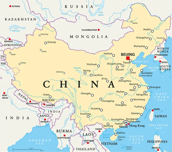
China Political Map With Clearly Labeled, Separated Layers. Vector Illustration.

Vector, 5.17MB, 6000 × 6000 eps
stock image Sunrise at Tung Ping Chau Hong Kong

Sunrise At Tung Ping Chau Hong Kong

Image, 13.18MB, 5610 × 3744 jpg
stock vector China Political Map

China Political Map

Vector, 2.72MB, 6789 × 6000 eps
stock image Detailed Earth. Korea and Japan

Detailed Earth. Korea And Japan

Image, 12.36MB, 5000 × 5000 jpg
stock image Shelter and sun beds in China Beach in Da Nang

Shelter And Sun Beds In China Beach In Da Nang

Image, 16.89MB, 4005 × 6000 jpg
stock vector Peoples Republic of China, PRC, political map. Area controlled by China in yellow, and claimed but uncontrolled regions shown in orange. Capitals and borders. English labeling. Illustration. Vector.

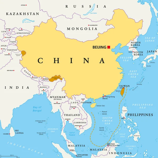
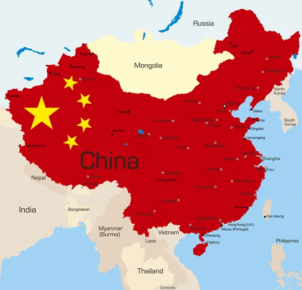
Peoples Republic Of China, PRC, Political Map. Area Controlled By China In Yellow, And Claimed But Uncontrolled Regions Shown In Orange. Capitals And Borders. English Labeling. Illustration. Vector.

Vector, 5.31MB, 8033 × 8033 eps
stock vector Taiwan Area, gray political map, with capital Taipei. Free Area of the Republic of China, ROC. Main Island and island groups of Taiwan, located between the East and the South China Sea. Illustration.

Taiwan Area, Gray Political Map, With Capital Taipei. Free Area Of The Republic Of China, ROC. Main Island And Island Groups Of Taiwan, Located Between The East And The South China Sea. Illustration.

Vector, 2.11MB, 6000 × 6000 eps
stock vector China map

China Map

Vector, 2.21MB, 3257 × 3090 eps
stock image Palm shelters and tourists at China Beach in Da Nang

Palm Shelters And Tourists At China Beach In Da Nang

Image, 12.17MB, 5400 × 3503 jpg
stock image Flag and Bamboo boat at China Beach in Danang Vietnam

Flag And Bamboo Boat At China Beach In Danang Vietnam

Image, 19.36MB, 4840 × 7315 jpg
stock image Flag and the China Beach in Danang in Vietnam

Flag And The China Beach In Danang In Vietnam

Image, 10.86MB, 5100 × 3400 jpg
stock vector southeast asia vector map with coordinates and scale.

Southeast Asia Vector Map With Coordinates And Scale.

Vector, 4.81MB, 3666 × 3100 eps
stock vector Map of Southeast Asia. Vector map in shades of maroon

Map Of Southeast Asia. Vector Map In Shades Of Maroon

Vector, 1.2MB, 6000 × 4500 eps
stock image Man riding motorbike at China Beach in Danang in Vietnam

Man Riding Motorbike At China Beach In Danang In Vietnam

Image, 7.5MB, 4100 × 2722 jpg
stock vector Detailed Physical World Map

Detailed Physical World Map

Vector, 21.06MB, 8192 × 5812 eps
stock image Palm shelter and sunbeds in China Beach in Da Nang

Palm Shelter And Sunbeds In China Beach In Da Nang

Image, 22.02MB, 5304 × 7952 jpg
stock image Tourists walking at the China Beach in Danang in Vietnam

Tourists Walking At The China Beach In Danang In Vietnam

Image, 9.92MB, 5100 × 3400 jpg
stock image Physical map of the world, satellite view of  Southeast Asia. Globe. Hemisphere. Reliefs and oceans. 3d rendering. Element of this image are furnished by NASA

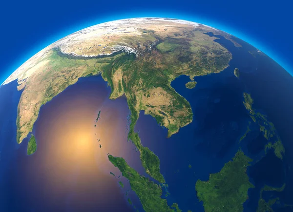
Physical Map Of The World, Satellite View Of Southeast Asia. Globe. Hemisphere. Reliefs And Oceans. 3d Rendering. Element Of This Image Are Furnished By NASA

Image, 9.57MB, 5511 × 4000 jpg
stock image Ocean view at the China Beach in Danang in Vietnam

Ocean View At The China Beach In Danang In Vietnam

Image, 14.47MB, 6900 × 4616 jpg
stock image Sculptures at the China Beach in Danang in Vietnam

Sculptures At The China Beach In Danang In Vietnam

Image, 12.36MB, 5848 × 4000 jpg
stock vector Shanghai and the Yangtze River Delta, gray political map, with major cities. Megalopolis of China, located where Yangtze River drains into East China Sea, with Hangzhou Bay and Zhoushan Archipelago.

Shanghai And The Yangtze River Delta, Gray Political Map, With Major Cities. Megalopolis Of China, Located Where Yangtze River Drains Into East China Sea, With Hangzhou Bay And Zhoushan Archipelago.

Vector, 3.21MB, 6000 × 6000 eps
stock vector Highly detailed World Map and navigation icons with globes

Highly Detailed World Map And Navigation Icons With Globes

Vector, 12.14MB, 8192 × 5055 eps
stock vector Political Physical Topographic Colored World Map Pacific Centered

Political Physical Topographic Colored World Map Pacific Centered

Vector, 12.4MB, 8800 × 4556 eps
stock image Fog covering mountains in the Hainan island, China

Fog Covering Mountains In The Hainan Island, China

Image, 5.86MB, 4590 × 3050 jpg
stock vector Political World Map Pacific Centered

Political World Map Pacific Centered

Vector, 8.85MB, 8800 × 4371 eps
stock image Sea view in the China Beach in Danang in Vietnam

Sea View In The China Beach In Danang In Vietnam

Image, 17.32MB, 6900 × 4602 jpg
stock vector Map of Southeast Asia. Vector map in shades of grey

Map Of Southeast Asia. Vector Map In Shades Of Grey

Vector, 1.19MB, 6000 × 4500 eps
stock image Landscape from bird view of Cargo ships

Landscape From Bird View Of Cargo Ships

Image, 6.81MB, 5000 × 3333 jpg
stock image Illustration of very fine outline of the world (with country bor

Illustration Of Very Fine Outline Of The World (with Country Bor

Image, 2.41MB, 6250 × 4167 jpg
stock vector China

China

Vector, 1.31MB, 3679 × 3540 eps
stock vector Korean peninsula highly detailed vector map with administrative regions,main cities and roads.

Korean Peninsula Highly Detailed Vector Map With Administrative Regions,main Cities And Roads.

Vector, 2.03MB, 3009 × 5600 eps
stock image shanghai skyline at night

Shanghai Skyline At Night

Image, 9.46MB, 5064 × 3360 jpg
stock image Shanghai Bund building and skyline

Shanghai Bund Building And Skyline

Image, 9.42MB, 5760 × 3840 jpg
stock vector seamless Traditional japanese seigaiha ocean wave pattern

Seamless Traditional Japanese Seigaiha Ocean Wave Pattern

Vector, 2.23MB, 5000 × 5000 eps
Page 1 >> Next